2013 The Mexican Bajío

Header 5.24.13

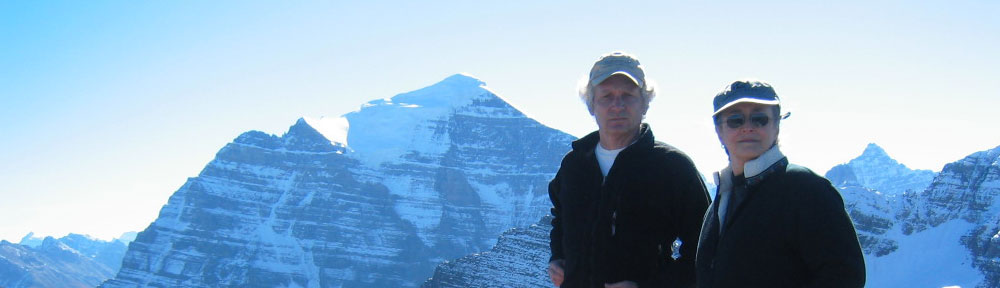
The recipe for this trip was one part relaxation, one part Spanish school, and one part butterfly excursion. We swapped out our hiking plans for bicycles, and pyramids.

Catholicism pervades life in Mexico’s central plateau, known as the Bajío. There’s Catholic and then there’s Bajío Catholic.

Catholicism

Mexico is the world’s second-most-populous Catholic nation after Brazil.

Our destination, the state of Guanajuato, is Mexico’s most Catholic.

pope

This is not lost on the Catholic Church.

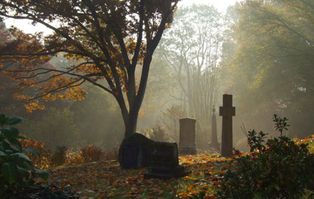
In 2012 Pope Benedict XVI visited the state of Guanajuato and held a giant outdoor Mass near a mountaintop statue of Christ.

Which just so happens to be at the exact geographical center of Mexico.

We drove by on our way from and to, the the León airport.

We had pre-arranged, through our Spanish school, a ride to San Miguel, about 90 minutes away.

This statue of Christ, known as Cristo Rey, is 75 feet tall, and stands at an elevation of 8,461 ft above sea level.

cubilete

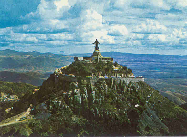
Cristo Rey is the second monumental statue on the site.

An anticlerical, Atheist, Mexican government used a whole lot of dynamite to blow the first one to smithereens in the early 20th century.

Not surprisingly, their symbolic gesture failed.

Metaphors rarely succumb to explosives.

The conflict between the Atheist, Mexican government and Mexican Catholic faithful is known as Mexico’s Cristero War and claimed up to 250,000 lives.

In the past five years, the drug-war violence in Mexico has claimed around 50,000 lives.

All our research said that San Miguel should be OK. Still, we played it safe.

2013-02-11T111237Z_01_TGN310_RTRIDSP_3_POPE

As we drove by Cristo Rey, our driver Martín explained (in Spanish) the finer points of the Pope’s helicopter fly-over blessing of the statue.

When we asked about drug-related violence in San Miguel, he laughed.

I chose to take it as a good laugh.

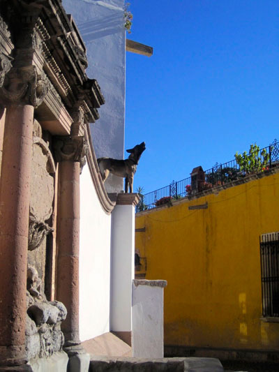
San Miguel de Allende

This was confirmed, soon thereafter.

stwith-dome

At our first dinner, in our home stay in San Miguel, a fellow student, Michelle, commented that after a month in San Miguel, she felt safer than in Seattle.

Michelle looked and acted like any upper-middle-class, retired woman from anywhere, USA. The wrinkle- she and her husband no longer have a home.

They live 6 months every year in China. The remainder, they divide up between the USA and grandchildren, and other destinations such as San Miguel.

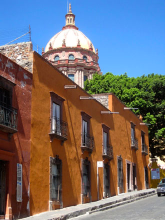
A street scene near San Miguel’s historic center to the right.

Curiously, when we tell our Mexican travel tale to friends, they invariably stop us, when we get to “home stay.”

dinner-table

“You stayed with a Mexican family?”

“Yep, and we had a great time!”

Good company, great food, great location, and most affordable.

What’s not to like?

Truth-be-told, we backed into it.

We started with hotels, and B&Bs, then backed off to a suite at the school. A home stay was even less expensive – and three meals a day were included. Our first home-stay choice was full up.

We think we did even better with Maria and Alexandro.

courtyard better

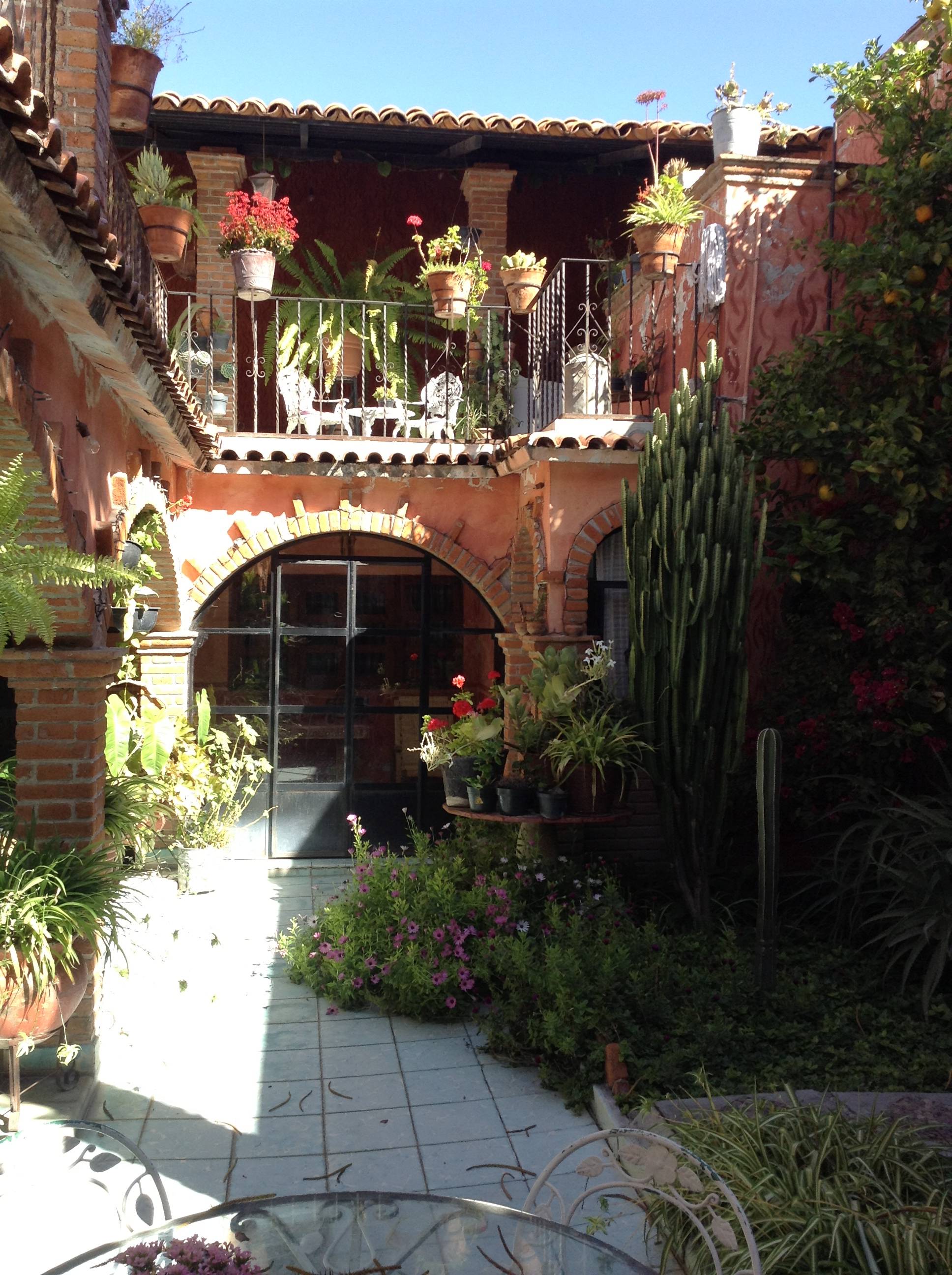
A wall to the street and a lush courtyard inside, Aurora No.4 was a traditional Mexican home.

The previous owner had twelve children, and rooms to accommodate them all.

Maria and Alexandro also have a family, but their kids are grown and gone now.

Their empty-nest solution was to open their home to students.

Seems to be working all the way around.

They get mostly entertaining guests, and cash.

Guests get a home-away-from-home, wonderful home cooking, and most-reasonable rates.

We had a free day before we headed off for Michoacan to visit the Monarch butterflies. We spent it walking the Centro Histórico of San Miguel.

Our first stop was the Jardin, the center of town, and only a ten minute walk from Maria and Alexandro’s. El Jardin is the central square of San Miguel, complete with locals, tourists, laurel trees, iron benches, street venders, and the Parroquia de San Miguel Arcángel.

jardin-parroquia

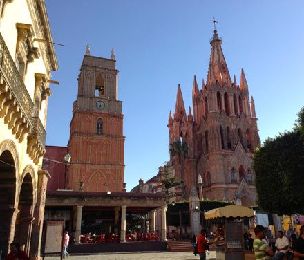
These days, the Parroquia is pretty much the symbol of San Miguel.

And rightly so.

The neo-gothic, pink sandstone towers of the church [on the right] are both remarkable and inspired.

The church itself was constructed in the 16th century, but this brilliant facade only dates from the 19th century.

Imagined from european postcards, the towers were designed and built by an indigenous bricklayer. Today, 100+ years later: they’re the symbol of San Miguel.

The church attached to the tower on the left, Iglesia de San Rafael, is older yet, and has stories too.

Apparently there was a time, centuries ago, in San Miguel, when city streets were not considered safe for the wealthy on their way to church.

The solution was to build tunnels from the larger homes to the church. These tunnels were large enough for horse-drawn carriages. Purportedly they’re still down there.

dome-and-colors

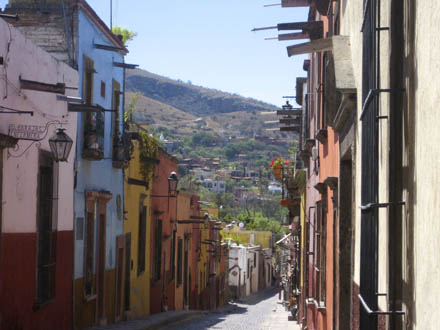
San Miguel is 500 years old.

A bit off the beaten track, the modern world passed San Miguel by, leaving the colonial architectural fabric of the city intact.

80 years ago,  artists and writers discovered San Miguel. Next came the counterculture. Today monied ex-pats rule the day.

starbucks exterior1

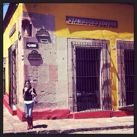
San Miguel has the most elegant Starbucks, I have ever encountered.

Right off the main square, tastefully ensconced in a centuries-old historic building.

From the outside, it looks a bit on the wild-west side.

Which it probably was.

I don’t doubt that six shooters are responsible for a few of the nicks in the stone, or that horses tied up out front.

starbucks2

Inside it feels like a high-end European boutique hotel lobby.

Complete with 14 foot high ceilings, tasteful, upholstered furniture, and original artwork.

Fast wireless internet connections too.

A whole lot of money was spent to deliver this Starbucks’ experience.

Clearly a popular destination for both well-do-do Mexicans and ex-pats.

This Starbucks is probably a 21st century metaphor of sorts for the mix of multinational corporation, developing country, and cyberspace.

A bit William Gibson, sans cyberpunk.

In 2008, UNESCO declared San Miguel, a World Heritage Site.

Today the old, old San Miguel is still here. There are no parking meters, no traffic lights, no stop signs and no gaudy fast food restaurants.

There are speed bumps to be reckoned with, and pretty police.

To my mind a a rather small price to pay.

San miguel colors

Professor Jorge Arteaga Soto, our school guide, explained that in San Miguel, only five colors are allowed for facades.

Apparently there’s a bit of flexibility when it comes to tints and shades.

Our trip to see the Monarch butterflies was to leave @ 7:00 AM the following morning- from St. Paul’s Church, which according to Google Maps was about a 25 minute walk from our home stay.

We found the church, and walked back. 25 minutes was about right.

Monarch Butterflies

The next morning before dawn, walking in the opposite direction, the experience was rather different. We had decided to walk just to see what San Miguel was like at this hour.

It was really dark.

We missed our first turn. It was a workday and a most-agreeable, local, middle-aged guy loading his pick-up truck, took the time to walk us back on route. All conversations were in Spanish.

We passed a solitary ghost-like street sweeper, she was cleaning the street cobbles with a handmade long-bristeled broom, which could reach down in between the stones.

Sharon was concerned we were lost. I put up a good front.

A couple of semi-lucky turns later, we arrived at St. Paul’s Church, right on schedule.

audubon

We threw our packs in the back of the van, took our assigned seats and were off for Michoacán, with Audubon Eco Journeys de Mexico.

We had picked Audubon, because of Mt. Auburn Cemetery in Cambridge.

Sharon and I have been walking Mt. Auburn for years now, as part of our get-in-shape regimen.

mtauburn1

Mt. Auburn is a birder place. A 174 acre landscaped oasis in the urban desert.

Birders are a curious breed. Eccentric is probably an understatement.

The first couple of years, they’d walk by, like we weren’t there.

Then ever so slowly there was recognition.

First a nod, then a word or two.  Remarkably recently we have been having real conversations. Albeit short.

Birders tend to be on the geeky side. Smart and organized. Sensitive too. A bit out on the Asperger’s spectrum.

Not a problem. A bit obsessive is an easy trade-off for smart and sensitive.

The question I ask myself as I look in the mirror: Am I becoming one of them?

audubonvan

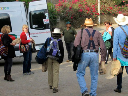
We felt right at home in the Audubon van for Michoacán.

This was an English speaking world.

Several Canadians, and several Americans, with a sprinkling of ex-pats.

Three hours + later we arrived at Agua Blanca Canyon Resort in Michoacán. We had the rest of the day to ourselves. We would visit the Monarchs the next day.

Aguas-blancas1

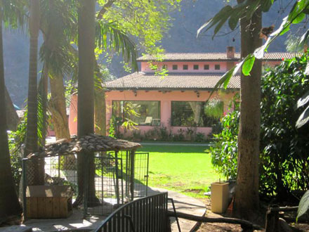
Agua Blanca is a family affair, run by the latest generation.

Our host explained that his personal crisis had peaked when doctors had only given him months to live.

It turned out to be a mis-diagnosis.

He’s still here and running Agua Blanca.

A changed man.

aguas-blancas2

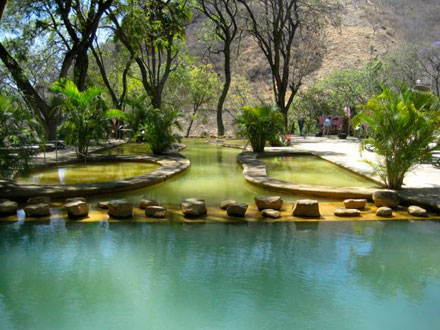
Agua Blanca is known for it’s outdoor thermal mineral hot springs pools.

These mineral pools were once reserved for Aztec Emperors.

The waters are purportedly good for arthritis,  rheumatism, the kidneys and liver, blood pressure, digestion and sleeping problems.

The mineral content was indeed high. I felt extra cork-like as I bobbed around clutching my beer.

The running joke was that the years were melting away. The question was at what age we stop the process by getting out. I thought 32 would be about right. A Swiss-German woman piped up,

“Do you really want to go through the 40s and 50s again?”

She had a point.

As we were leaving the next day, I bumped into the owner. I thought his website didn’t do his resort justice. He told me that soon he would have a new website up.

I just checked.

It’s up. A sideways step, at best.

I’m not sold on the wisdom of headlining, the healing “radioactive waters.”

If I were in my my 40s, I might have cause to pause. From a 60s perspective, I can shrug.

The wisdom of age, or the indifference of age?

We piled into the van and headed off for the butterflies. The drive usually takes about an hour. It took us a bit over two.

After 30 minutes or so, we came to road block. Really big rocks had been strategically placed in the highway to stop traffic in both directions.

We slowed to a stop, about six cars back- and three beats later were headed back the way we came. It could have been this or it could have been that. Apparently, in Mexico, in such circumstances, you just get out of there ASAP.

Rodrigo, our trip leader told us not to worry, we would have plenty of time for the butterflies, as we would be parking in the limited-access lot closest to the entrance.

So we pull up to to main parking lot, Rodrigo leans out the window and after a lively conversation in Spanish we were waved up the limited-access road. Rodrigo tells us, with a twinkle in his eye,

“I told them I knew their boss.”

My Spanish is good enough to know that he really said,

“I’ve got a bunch of old people.”

Which I suppose was true enough. Ages ranged from 40s to nearly 90.

Our van parked at around 9000 feet above sea level. The butterflies were around 10,000 feet. Sharon and I were the only ones who hiked up. Everyone else rode horses.

butterfly

We had our own spanish-speaking guide.

The hummingbirds were out and their favorite flowers were blooming.

We saw a few Monarchs.

The butterfly to the left is a guy.

You can tell by the little black dot on the black line next to his lower abdomen.

We made great time and soon rejoined our group, for the last level quarter mile to the slumbering Monarchs.

monarchs

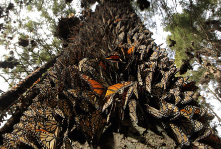
I’m not sure what I was expecting, but this was something altogether different.

Borrowed photo.

Think butterfly hive-mind.

Packed into  tightly clustered pendulous masses, the butterflies were in a “torpor”, not as deep as hibernation, but still a very deep sleep.

flyingmonarchs

After flying up to 2000 miles, they’d earned it.

Another borrowed photo, that captures some of the feeling.

Each fall the monarch butterflies in the eastern USA travel thousands of miles to spend the winter in forests on 12 mountaintops in central Mexico. It is said to be the most spectacular migration carried out by an insect.

We were on one of those 12 mountains, in the Rosario Monarch Butterfly Biosphere Reserve- the lower left butterfly on the map below. The Rosario Reserve has been designated a World Heritage site by UNESCO.

tam_map_web

It was March and the Monarchs were beginning to wake from their hibernation and at times, the air would become a swirling mass of orange and black as tens of thousands of Monarchs took to the air with a shift in the light or the breaking of a branch.

The traditional indigenous locals believe that the monarchs are the souls of ancestors who are returning to Earth for their annual visit.

It felt like that.

Bicycles

biciburro

Back in San Miguel we hiked over to Bici-burro, a local bike shop I’d been corresponding with.

We had a long talk about trip options with Beto, the owner.

We also talked about dogs, life, death, and Mescal.

Beto’s dog Murri to left.

5 hours and a bit over 10 miles seemed about right for our bicycle ride.

Sharon is not a bicycle person. She has always hated trying to shift gears and she’s never ridden off-road.

Thankfully shifting has come a long ways in the last 20 years.

betosharon

Our first stop was the first San Miguel,  San Miguel Viejo dating from the 1530’s.

We rode up to the church. Not a tourist in sight.

Locals were setting up for a party.

Beto and Sharon to the right.

From there we worked our way out into the countryside first on dirt roads and then trails.

Loved the falcons, the church ruins and the broken bridge.

Thankfully we didn’t fall over on our two -on bike- river crossings.

The water in the Laja River wasn’t deep (16″ or so), but we would have gotten very very wet if we had tipped over.

Once we crossed the Laja River, several falcons made their appearance.

I looked up just as one slammed into another bird peacefully perched minding its own business. A cloud of feathers later, the intended prey made its escape.

oldchurch

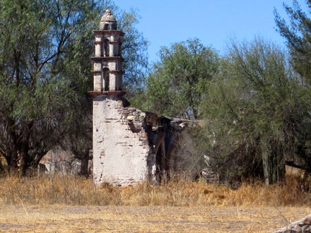
Beto explained that the church ruins were remnants of the early Spanish expansion into the region.

Crumbling amidst fields, they have been lost to the modern world.

This one was probably from the 16th or 17th century.

Once an outpost, now a postscript to a forgotten world.

halfbridge

Beto explained that the missing bridge half, had been blown away during the Mexican revolution.

We rode up onto the old road and looked off and down.

Our return route had no glamour, but 100% local flavor.

Sbikerr

Not everyone in San Miguel lives lux.

This was literally the other side of the tracks.

Backyards, dirt roads and cactus the size of small trees.

We dropped down and rode the final stretch back along the railroad tracks.

Spanish School 

Habla Hispana

The new wrinkle for this trip was Spanish School.

Sometime in my mid to late 50s, I decided to take up the challenge of a new language.

“Mas vale tarde que nunca.”

“Better late than never.”

At registration, Marta, who runs the school along with her sister Angelica, asked me – in Spanish – about my Spanish education. I stumbled through a crude attempt at describing my self-study.

Next stop, Nivel Principiante, Beginning Level, for me.

A blessing in disguise, I felt curiously liberated. My reading and writing is much better than my conversational skills. Floundering around in beginning Spanish turned out to be quite educational and entertaining.

We talked – in Spanish – about a lot things, including slang and Mexican-specific idioms, such as the “Britney Señal.”

britney senal

Britney Spears visited Mexico in 2002. Not in the best of moods she flipped off the cameras.

Mexicans took it personally,

And returned the favor, with a twist, naming her gesture in her honor.

The “Britney Sign,” as its known today throughout Mexico, to the right.

I have no doubt that there are plenty of folks south of the border who know this definitive gesture, as the Britney Señal,

And who have no idea who Britney Spears is.

It would be a curious twist of fate, if in the twenty-second century, Britney’s name lived on, only as a crude gesture, embedded in foreign culture.

Not out of the realm of possibility.

At registration, when Marta asked Sharon about her Spanish- in Spanish- Sharon, rattled off a few jokes. Not surprisingly it was Nivel Avanzado, Advanced Level, por mi esposa, for my wife.

Sharon learned her Spanish on the streets of Tampa Florida as a child. I have noticed that  when she starts speaking Spanish her persona changes, complete with body language.

She becomes a Cubana, a Cuban woman.

Apparently from some perspectives, a Cuban woman- from the wrong side of the tracks.

In Nivel Avanzado, there was a refined European woman, who had been living in the USA for some time.

Sharon shared with me that she thought that this woman considered her uncouth and unsophisticated.

Then, there had been a discussion of literature in class. The European brought up that she was reading “The Decline and Fall of the Roman Empire.”

222px-Edward_Gibbon_by_Henry_Walton_cleaned

A classic written by the English historian Edward Gibbon.

Published in six volumes, from 1776 to 1788.

Gibbon was both eccentric and brilliant.

And a rather good writer. A bit off the beaten path.

This European woman was rather surprised, when Sharon chimed in that she had read the complete text.

Apparently, Sharon then went on to analyze Gibbon’s work, and writing style – in Spanish.

I have no doubt, in depth, complete with the body language and flourishes of a Cubana.

I don’t doubt that this European woman was a bit stunned. She’d be far from the first.

That’s Sharon. The hardest of hardcore sophisticated intellectuals, with the body language and attitude of a girl from the wrong side of the tracks.

We spent 20 hours a week in Spanish class. We had optional afternoon activities three days a week, which left plenty of time for side trips.

Highlights of our side trips included the local pyramids and the neighboring town of Guanajuato. In the interests of space, I’m skipping Guanajuato- a great town.

Here’s my favorite Mexican postcard, which we picked up in the gift shop of the Diego Rivera Museum in Guanajuato.

alboroto-de-calaveras

The artist was a semi-local, José Guadalupe Posada (1852-1913). Unappreciated in his time, he died penniless and was buried in an unmarked grave. Today his genius is recognized internationally.

The title of this illustration: “Alboroto de calaveras felices Y chapuceras.”

Official translation: “Happiest and joker calaveras (skulls)”

Our rough translation: “Uproar of Happy and Shoddy Skulls.”

In any case, this is pretty much the perfect snapshot of the pagan side of the Mexico.

Pyramids

So how do you hide a pyramid?

With a lot of dirt.

jorgeyjade

Our guide, again Jorge, explained that back in the early 16th century, when the local indigenous peoples heard of the arrival of the Spanish, they buried their local pyramid- to hide it.

Jorge, our friend Jade, and the pyramid, known as the Cañada de la Virgen, above.

The mesa where the pyramid sits is flat.

Covered with dirt, the pyramid must have been a rather large, unnatural mound. Curiously, the Spanish never found the pyramid.

Nor did anyone else- until the twenty-first century.

Even with pieces of painted stone sticking out of the top.

Jorge said that as a boy, he used to climb up the mound, and had seen bits of a mural jutting up.

These were pieces of the Red Temple.

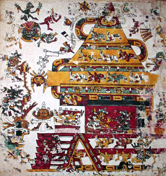
In 2006, in the initial stages of the excavation, the rest of the Red Temple was uncovered. Including a mural similar to that below (p.33 of the Codice Borgia)

page33

Bones were discovered beneath the red temple. Samples were sent for radioactive carbon dating. As expected they had been interred around 700 AD.

The twist was that this guy had died over 1000 years before that.

Which meant that his remains had been carried here by the people who built the pyramid during their migration into the region.

indiginosfolk

Not surprisingly, these indigenous people are are still here.

Photo to the right from the Visitor’s Center at the Canada de la Virgen.

Today, Otomis and Chichimecas can be seen on the streets of San Miguel.  They come to town to sell and buy, attend church- and march in all night Catholic processions.

The Procession from Atotonilco

guys-in-procession

Sharon and I got up before dawn on our last full day in San Miguel and headed for the Templo de San Juan de Dios to greet the Catholic procession from the small neighboring town of Atotonilco.

I particularly like the juxtaposition of the two pictures above. These truly intensely devout guys could very well be the same proud pagans, painted up, and ready to rumble, in the second picture above. Just different days of the week.

Mexico is like that.

Once a year, this procession walks all night from Atotonilco, praying and setting off fireworks, while carrying three large statues.

procession

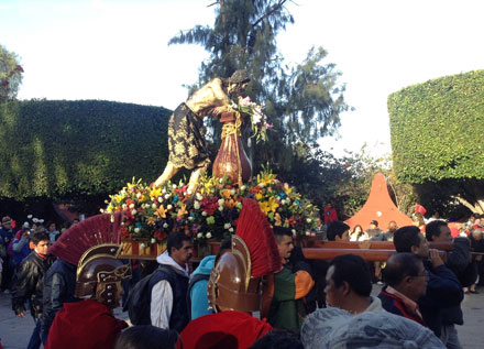
The most significant is El Señor de la Columna, widely revered for his ability to perform miracles.

There weren’t any tourists around, when we arrived in the plaza.

We snagged a front row curb. The mostly-local crowd soon packed the plaza solid.

As the all-night procession arrived, Sharon noticed the locals crossing themselves in a two-staged sequence, she wasn’t familiar with.

First they did a crossing on their faces. Then the traditional crossing starting with the left shoulder.

We never did figure out the face crossing.

In any case, it is all about “placing the cross on oneself.”

Properly.

Although I’m a lapsed Buddhist myself, I can relate. We certainly all have crosses to bear.

Whether the sequence is simple or more complex,

Best we should know how to place those crosses on ourselves properly.

2012 The Back Way to Machu Picchu

This was Indiana Jone’s country.

I suppose it shouldn’t have been a surprise.

After all, the character of Indiana Jones was based on Hiram Bingham, the so-called discoverer of Machu Picchu.

The Salkantay Pass at 15,213 ft. was above tree line- as expected.

As we came down the backside, there were stunted gnarled trees- as expected, then in short order we hit the “Ceja de la Selva,” or “Eyebrow of the Jungle.”

Cloudforest.

This was a surprise. At least to me.

Palm trees and orchids at 9000+ feet. Complete with flocks of parakeets.

And lots of mud.

Vital Statistics

At our pre-trek meeting, our lead-guide Antonio announced that the trek proper would be 49 miles from Marcoccasa to Machu Picchu.

Sharon turned to me,

“How come it keeps getting longer?”

She had a point.

I’d been telling her it would be 39 miles.

I mumbled and changed the subject to Pisco Sours, the national drink of Peru.

“Tasty ¿No?”

We started our trek at Marcoccasa, 11,979 ft.

The highest point was Salkantay Pass at 15,213 ft.

The ending (trek) elevation was the Llactapata Pass train station at 5809 ft.

Total cumulative ascent: 7724 ft.

Total cumulative descent: 12,428 ft.

Total distance: somewhere between 39 miles and 49 miles.

3 wheeled Asian Taxis, Mummy Hotels, and Targeted Arson

The van picked us up in Cuzco at 7:00 in the morning. We had three stops before our trailhead at Marcoccasa.

First up was the town of Limatambo, 1.5 hours from Cuzco. We got a bit of local flavor in the town market, but what sticks are the Asian taxis.

In a very 21st century twist, the town was swarming with 3 wheeled Asian taxis.

Complete with Asian graphics.

Fuel efficient, and priced right, these vehicles are the perfect fit for semi-rural Peru.

The dragon graphics seemed a bit out of place, but apparently that’s the way they come.

Our second stop were the Inca ruins of Tarawasi.

From reading our guidebook I understood that the Inca worshipped their ancestors and that the Inca royalty were special.

Mummy special.

Inca emperors were mummified. And as such, they lived on. Quite literally.

They continued to live in their palaces, and were treated as if they were still alive.

Complete with trips to the country.

When they stopped for the night, they needed somewhere to stay.

Tarawasi was such a place. A mummy hotel, if you will.

Lingering at Tarawasi, I got it emotionally.

It’s one thing to read a guidebook and quite another to stand in the niches where the mummies stood. And to look out onto the valley where they looked with their metallic golden eyes.

Our third stop before our trailhead was the mountain village of Mollepata. Mollepata is far, far off the beaten track. A town supported by farmers and (trek) mule drivers.

As we were walking back up to our van, I asked Whilder, our assistant guide, where the money came from, for the work on this side road.

It was pork.

There was an election coming up.

I asked about the trail fees which purportedly might be collected in Mollepata.

“You don’t have to worry about those, they burned the building down.”

The mayor had set himself up as the trail fee collector. The fees went directly into his back pocket. Nothing shared with the locals who did the trail maintenance.

The final straw could have been predicted.

Folks using the trail, simply skipped Mollepata and hence the fees.

Since tourism brought in much needed dollars, this was not viewed favorably.

The locals voted.

They burned the mayor’s tollhouse down.

And it has stayed burned down.

Targeted arson. With intent.

Apparently, message received.

Acclimatization, Lux Lodges and Shamen

Our trek began at a place called Marcoccasa at 11,979 feet above sea level.

This first day’s acclimatization hike took about 5 hours. I felt pretty good.

I’d chat with fellow trekkers, drop back to look for birds, then speed up to catch the main group, and so forth.

It was only in the last stretch that I started to feel not-so-great.

When we got to Salkantay Lodge at 12,690 ft, I had a serious case of the blahs. Sitting in our room, I felt vaguely hungover. I dozed off, propped up against the headboard of the bed.

I woke at dinnertime.

Sharon (competently) pointed out that I should tell our guides that I didn’t feel right.

I thought to myself, “Bah Humbug,” but did pull Antonio aside before dinner.

He clipped this little gizmo on my finger.

“No wonder you don’t feel right, your oxygen level is only 86%. Normal starts at 87.

Do you want some oxygen?”

“Nah.”

My big regret on this trip was not saying, “Yes.”

And hence setting up a wonderful photo-op.

After dinner, I was feeling better. My oxygen level of 89% confirmed my inner world.

The op opportunity had passed.

The lodge though, looked even better. “Lodge” doesn’t do the place justice. Upscale eco-hotel is more like it.

Our bathroom said it all. Glass shower enclosure with a rain-shower.  The towels were warmed on their own warming rack. All fixtures were high-end European.

A tip-of-the-hat to the folks who designed this place. They managed to combine minimalist European with comfortable Eco-Lodge.

No small feat. And it was done in the local vernacular complete with a thatched roof and native stone.

The art on the walls was museum quality.

Selections from the owner’s private collection. What I thought, at first glance, was a print, turned out to be an authentic antique Incan condor-feathered headdress, hanging over the bar.

Better than most anything we had seen in Cuzco museums.

I awoke the next day early at 5:30 AM. I wandered the hotel alone. Yep, nice place.

This day was another acclimatization hike, a round tripper to a glacial lake a couple of miles above the hotel. Anyone who wished to, would get a chance to “swim,” and there would be a couple of shamen to do a blessing ceremony.

At breakfast I told Antonio that we had ashes of our most favorite cat with us. “It would be great, If these could be included in the ceremony.”

Antonio shrugged and suggested that on today’s hike,

“Don’t talk so much, and keep an even pace. You’ll feel a lot better.”

Points well taken.

At about the 3/4 mark, we passed the shamans. A couple of remarkably cheerful-looking guys sitting by the side of the trail in the drizzling rain.

Lucio is the older on the right.

Sebastian, with the blue hat, is his student.

Interesting folks.

I had been quiet and deliberate in my hiking, and felt OK- all things considered.

Humantay Lake is 13,845 feet above sea level. Turquoise from the glacial melt. The glaciers didn’t quite reach the lake, but they were close. Mount Humantay , at nearly 20,000 feet loomed above, more felt than seen. Low cloud ceiling.

Our guide announced half-in-jest,

“Anyone up for a swim?”

Three of us took the plunge. As Sharon put it later,

“None of you guys are exactly Greek Gods.”

Yep.

And never will be.

And that water was cold!

I had neglected to bring a towel. Regret #2 of the trip.

The rain had picked up, and the shamans had set up their blessing ceremony under a tarp.

I was a bit surprised when Antonio asked me for YB’s ashes. Just in case, I had them in the bottom of my pack in a ziplock bag.

As it turned out, YB’s ashes anchored the offering, surrounded by white and red carnation petals.

We stood or sat in the drizzling rain as the shaman added layer upon layer to the offering.

A falcon flew by.

Pieces of the glacier peeled off and fell. The sun came out, disappeared and came out again. Over and over.

Lucio chanted continuously in Quechua as he built the offering.

I felt this heat on top of my head.

I was thinking about all this, as I slowly made my way back down the mountain.

Who should stroll up, but Lucio and Sebastian.

I was the last of our group along with our assistant trilingual guide Whilder, who spoke English, Spanish and Quechua.

I asked Lucio, through Whilder, about the sensation of heat on the top of my head.

“That was the blessing of the Apus [mountain gods].”

The falcon?

“A messenger of the middle world.”

Glacier avalanches?

Apus again.

I told Lucio about a recurring dream, where I am walking between very high, ancient mountain cliffs, with no one around. High on the cliffs I can see caves, which had been occupied centuries, or eons, before. I sense that the spirits [or people] are still there.”

Lucio answered with a noncommittal,

“That’s a good dream.”

I’m thinking, this place is just like that.

The blessing ceremony at the lake was supposed to end there with the burning of the offering. For better or worse, the day was too wet. Lucio and Sebastian, brought the offering back to the lodge.

The lodge had an outside fire pit, where a suitable fire could be started.

An hour or so later the fire roared, Lucio gestured for all of us to leave, before he placed the offering on the fire.

That’s the way such offerings are done.

No waving goodbye allowed.

An hour later Sharon and I were sitting once again with Sebastian, Lucio and Whilder, in an alcove at the back of the hotel for a private coca leaf reading.

Lucio would ask us a question in Quecha. Sebastian would translate it into Spanish. Whilder would translate into English. Sometimes we never got to the English. Sharon was the focus, and her Spanish is, well, pretty good.

Sometimes Lucio would ask Sharon to blow on the coca leaves. Sometimes he’d blow on them himself, as he chanted. Then he’d flip the leaves quickly.

Flip. Flip. Flip. Ah.

Flip. Ah. Flip. Flip.

The “Ah’s” would come when the leaves would do something unusual. Point in a particular direction or land juxtaposed to the pattern up, or land upside down.

Then there’d be another round of questions.

And so forth.

Lucio was both perceptive and sensitive, as were the coca leaves. A lot of ground was covered.

I learned a lot about everyone at the table, including myself. The key seems to be  synchronicity. Really easy when the synch is there. A mighty struggle when it isn’t.

The essence of any magical, spiritual, or artistic endeavor.

Afterwards we asked Whilder about Lucio and Sebastian.

They come from a particular high mountain area renowned for Shamans. The area was only opened up in the 1950s.

A Peruvian Inca twist on “Lost Horizons” or “Shangri-La.” An isolated area where centuries’ old spiritual traditions have lived on into the modern world.

We asked Whilder about Peruvian Shamanism.

There are three levels. Lucio was a middle level Shaman.

Sebastian, as his apprentice, was the lowest level.

The highest level Shaman have to have survived a lightning strike. Obviously there is a lot more to it than simply that, but living through the strike is the acid test.

A group of these heavyweights were going to get together in the area in the not-too-distant future, to do a blessing ceremony for the modern world.

Guests not invited.

After dinner, Sharon and I called it an early night. Tomorrow would be our big day.

Over Salkantay Pass

Our start was early, as our group hoped to make it over the pass before the bad weather arrived.

We had a climb of almost 2500 feet, over 5 miles, to reach Salkantay Pass at at 15,213 ft. In good weather it usually takes 3.5 hours.

The weather was still good-ish. A touch of blue sky, through mists and layers of clouds.

I was feeling pretty good. Time to celebrate my 61st birthday with a hike.

As we headed off, I repeated to myself,

“Keep it steady and and don’t blabber.”

We headed up the valley. The climb was steady.

The cloud ceiling cut off the looming peaks, but we could feel they were there.

After a couple of hours, we turned left, up and out of the valley. This was the steep stuff.

With the switchbacks though, it was manageable.

We headed up.

After maybe a half mile or the sun broke through.

We had a rainbow, as we looked back down.

Check out the little blue dots just above the rainbow. Those are horses with blue packs. The winding path they’re next to is the trail we came up. The white ribbon in the upper left is the white water of the roaring stream we followed up the valley.

A tributary of the Amazon.

The larger orange dots at the bottom left are pack covers on horses. The inverted “V” at the lower right is a turn of the switchback directly below.

Our group had two groups of horses. The pack horses which carried everyone’s stuff lodge-to-lodge, and two horses which accompanied our group. The latter carried water, snacks and emergency equipment.

These horses doubled as emergency transportation. Should anyone get into trouble, they could ride.

Sharon and I had brought apples from Cuzco for our accompanying horses.

No go.

Our guides explained that these local horses don’t know what apples are.

We asked the horses’ names.

“Well the first one is 911.”

And the second?

“Well he’s [pause]… 912”

Laughs all around.

Once out of the valley, with the switchbacks behind us, and maybe 4 hours into the day, we took an official scheduled break.

Antonio offered us some Peruvian jerky.

Tough stuff.

Sharon above trying to try a piece of Peruvian jerky.

This was the last of the blue sky for the day.

We were only 45 minutes from the pass.

But in those 45 minutes, the weather closed in.

It was snow, slush, and mud.

Visibility, not much.

No matter. In short order we were at the pass.

Sharon and I had picked up pieces of quartz back down the mountain.

We placed them on the cairns at the pass. We posed for pictures.

In a most-sweet gesture, the group broke into a rousing round of “Happy Birthday to You”

And so I turned 61 at 15,253′.

So far so good, but we still had a 4 mile, 2400 foot descent ahead.

The wet weather arrived in earnest. Sharon and I pulled out our new rain pants and water-proof pack covers, and headed down. Visibility was a couple of hundred feet. The trail quickly turned into a stream.

So much for dry shoes.

We arrived at Wayra Lodge soaked from head to toe, but in good spirits.

We really liked Wayra Lodge.

Modest and just about as far off the beaten track as they come.

Comfortable, a bit rustic, with lots of local flavor.

Wonderful wind-swept site,12,812 feet above sea level.

Ahead the valley drops away. On one side, cliffs down to another churning steroid-fed stream.

The uphill, takes no prisoners.

We could appreciate the real drama, the next morning, when the clouds and rain lifted.

Back from where we’d come, Mount Humantay appeared.

Or should I say, Mount Tucarhuay?

The real Humantay, at least according to the the Carta Nacional published by the Instituto Geografico Nacional, is on the other side of the valley.

Our lead guide rationalized that locals call Turcarhuay, “Humantay,” and that’s why Mountain Lodges of Peru does.

My theory is that, Mountain Lodges of Peru goofed early on, and now there’s no looking back.

Just like rocks added to a cairn, one internet reference reinforces another. One reality becomes another. And one mountain’s name becomes another.

With no roads, it took more than 6,000 mule trips to build Wayra Lodge, and I would guess also a helicopter drop or three.

To their credit, Mountain Lodges of Peru hires locally.

Which in this neighborhood, means the staff wakes every morning far far off the grid, hikes down to the lodge, pulls on their uniforms, and transitions into a multi-lingual international world complete with satellite internet.

Incan 15th century meets 21st century.

Cloudforests, Plasticized Chickens and Papas

Generally speaking, Peru has two seasons, wet and dry.

We were right between the two. I had hoped for dry-ish, but we got wet-ish, all the way down the 3400 feet and 6 miles to  the next lodge.

No rain, but mud.

Our guide suggested that we all wear our rain pants. Not for rain, but for the mud. Knee-deep + and such. He also suggested insect repellant.

There’s insect repellant and then there’s insect repellant. We were prepared with 100% DEET, Jungle Juice.

Hardcore stuff for avoiding hardcore jungle diseases.

We could have gone organic, but one picks one’s battles.

We bought our Jungle Juice at our local REI in Boston. A petite, bubbly, 20-year-old coed walked us through our choices. She had recently spent several months in the Costa Rican jungles.

“Hey Malaria’s no big deal. Hey, my Costa Rican boyfriend has had malaria a couple of times. Those vaccines cost money. Malaria is no big deal.”

After her pep talk, we reached for the strongest stuff.

Purportedly 100% DEET can melt  rain gear,  but we had no such problems.

Sharon also had her mosquito netting.

As the day went, bugs were not the problem.

It was the mud.

With clever footwork, we avoided the worst.

The third guy, with the yellow towel is a dentist.

This dentist had run with bulls in Pamplona three times. The last time, the guy next to him had been gored and trampled.

He didn’t think he’d run Pamplona again.

He had lots of other life-endangering stories. The time his oxygen ran out  on a deep sea scuba dive was one of his favorites. When he surfaced, his support boat couldn’t find him.

“I could have been left out there forever!”

Big smile.

I’m not sure what it is about dentists, and those in the tooth business. My last hygienist was into guns. Nice woman and ever so sensitive. But guns did it for her.

The transition from alpine to jungle was remarkable, mud and all.

Palm trees and orchids at 9000 feet.

Flocks of parakeets too.

We stopped for a break at a local’s place.

They had set up covered, open, thatched outdoor rest-areas next to the trail.

We sat and munched on our food and fed the chickens, who knew this game.

For dumb birds they played us well.

We asked about their plastic decorations.

“It’s to confuse the hawks.”

I’m not surprised that those 15th century hawlks found these 21st century plastic-enhanced chickens a bit disconcerting.

All styled up, with a Japanese, Manga-like flair, I found them a bit disconcerting too.

Mid-afternoon we trudged up to Colpa Lodge.

Another great site, this time at the confluence of three rivers.

And no, Sharon hasn’t gained 50 lbs.

She just has her rain pants on.

We had about an hour to clean up before the Pachamanca. I knew this was coming and was psyched.

A Pachamanca is a traditional festive Peruvian meal cooked by layering meat and vegetables with hot stones, and then covering the whole thing up with soil and leaving it to bake.

Kind of like a Hawaiian Kalua or New England Clam Bake, but in this case, traditionally Incan, including Incan staples such as guinea pig, alpaca, and a great variety of papas, or potatoes.

Genetic testing has provided proof of a single origin for potatoes: in southern Peru, and extreme northwestern Bolivia.

Following the Spanish conquest of the Incas, in the second half of the 16th century, the Spanish introduced the potato to Europe.

The rest is history.

Our Pachamanca was going to be close to ground zero for papas.

Can you guess the world’s largest potato-producing country today?

Yep, China.

Maple Sugar, Hardhats, and Landslides

Before our trip, we thought about what to bring for gifts. We settled on maple sugar candies. Tasty and unusual from a Peruvian perspective.

Online, I found a farm in Wisconsin, Maple Hollow, that made their own, in the shape of maple leaves, and ordered a trip-to-Peru’s-worth.

At the 11th hour I started to feel guilty. I had stumbled onto a section in our guidebook, where it was suggested not to bring sweets as gifts, as the locals didn’t have easy access to dental care.

In my mind’s eye, I pictured folks with rotten yellow teeth.

I need not have worried. Virtually every local seemed to have sparkling brilliant-white teeth.

A diet heavy in coca will do that.

The active alkaloids in coca maintain incredibly white teeth. The same oxidization that is responsible for overcoming high-altitude sickness also keeps the teeth pearly white and healthy.

“The coca leaf contains more proteins (19.9 per cent) than meat (19.4 per cent) and far more calcium (2,191 per cent) than condensed milk, and that it is richer in vitamin B-1 (276 per cent) than fresh carrots.

The next day as we headed out from Colpa Lodge, Sharon passed out yet another round of pure maple sugar candies to this staff group.

Sharon explained, in Spanish, that these sweets were made from the sap of a tree in North America with no added anything.

Our token maple sugar gifts were well received, as they were throughout our trip. I could see the curiosity and real interest in the sideways glances. As if to say,

“Hmmm. North American candies made from tree sap. Strange idea. Looks harmless. What do you think?”

The next day we headed off for Lucma Lodge. Back down to the river. Across, up and then down the Santa Teresa river valley, through more populated rural areas.

We were told we would have to negotiate bits of missing trail.

Hardhats would be required.

Felt a bit goofy.

Then again I thought, better safe than sorry.

We soon hit the missing section of trail, which explained everything.

The trail was simply gone.

Rocks on the trail preceding, pointed to the landslide danger above.

The vertiginous drop to the river, told the story of almost certain death 500+ feet below.

We picked our way up and around.

The photo to the left doesn’t quite show our 6 inch wide trail.

We passed across just below the dark section at the top left of the photo above.

I remember thinking,

“Don’t slip”

We didn’t. And no one did.

Good thing.

From here on, we walked mostly on dirt roads. Landslides had made the regular trail on the other side of the river impassable.

Landslides had come down on our dirt road as well. Crews were out clearing the debris. As we picked our way between workers over a good sized pile, one guy turned to another and said in Spanish,

“Well here comes Granny.”

Without missing a beat, Sharon added in Spanish,

“Well, I am 64”

Froze him in his tracks.

At one point I had asked Antonio, what Spanish accent Sharon had. Was it Mexican, Caribbean, European, or something else? He turned, looked me in the eye,

“She doesn’t have an accent.”

So I guess Sharon’s Spanish can flex Peruvian, just like her English can flex Southern, when the occasion warrants.

Antonio had warned us that our shuttle van might not be able to meet us as planned. Another couple of washouts.

The shuttle did show up as scheduled, but the road was a bit narrower and pitched to the side a bit than usual, in some sections.

Once again there was a long, long steep slope to a churning river.

In the worst spots, we got out and walked. The driver, then did his thing.

I could never decide whether this drill was because:

If the van was to be lost, better to only lose one local than than a dozen tourists? Or,

The driver wanted to keep the shuttle light with no shifting weight? Or,

Simply not scare bejesus out of everyone?

Maybe a bit of all three.

The shuttle saved us 4 miles of hiking. Nice to ride, even with a bit of adventure. Big difference between a 10 mile day and a 14 mile day.

The shuttle dropped us off a mile from Lucma Lodge.

A pleasant 1 mile uphill stretch on the newly-restored Llactapata Inca Trail.

This was the homestretch to Machu Picchu.

The Inca Kings used this trail.

Alive and mummified.

I liked the stonework.

Even if it was more or less reconstructed, which I suspect.

Lucma Lodge, at 7003 feet, was another gem, set in an avocado orchard.

This was banana and coffee country.

Looking kind-of jungle.

¿No?

We cleaned up and headed about 5 minutes back down the trail to visit a local coffee grower.

We watched as the Mrs. roasted fresh coffee beans over an open fire.

Our guide ground the roasted beans by hand.

Next the Mrs. brewed up a pot of about-as-fresh-as you-can-imagine organic coffee.

Yep it was great. One of the best cups I’ve ever experienced. Right up there with the Turkish coffee served at breakfast at the American Colony Hotel in Jerusalem.

This event took place in a small one room shack.

The original home, not long ago.

Underfoot, on the dirt floor, were dozens of guinea pigs, or cuy as they are called in Peru.

Cuy were first domesticated about 5000 years ago in the Andean region of South America.

These parts.

Roasted coffee beans were for sale. We brought home our share, as did most. We asked our guide and it turns out that our take-home beans, came through the local Co-op, a far more efficient operation.

As we headed back to Lucma Lodge, we noticed a satellite TV dish on a house next to the shack. Our Mrs’ home today.

Somehow I suspect their cuy live only in the performance-dedicated shack with the dirt floor, but I could be wrong.

Llactapata Ruins, Bamboo Forests and Aguas Calientes

I knew from the altitudes, distances and times quoted in our trek literature that our last day was going to be tough.

First we had an almost 2000 ft climb over 3 miles, followed by an almost 3200 ft descent over 4 miles, which in reality, as we were to learn, was more like a 3200 ft descent over about 2 miles followed by a 2 mile level walk to the train station.

My misgivings were reinforced by our guides’ curious silence about the day ahead.

The climb went well enough. In 2-3 hours we were at Llactapata Pass, at 8974 feet.

This was a jungle pass.

What you can’t see in the photo to the right is that Sharon’s glasses are completely fogged up.

Yep, jungle at 8974 feet above sea level.

Pretty quick, we hit the view point I had been waiting for.

Our first glimpse of Machu Picchu from the backside.

I was prepared to be underwhelmed.

I wasn’t.

Next up were the Llactapata ruins.

“One of the most attractive ruins around Machu Picchu is Llactapata, a delicate Inca site hidden high in the cloud forest with the charm of having a superb view, the best, of the Sacred Citadel [Machu Picchu].

Early in the morning you can watch, as the Incas themselves certainly did, the clouds clear as the sun’s rays hit first one, then other parts of the citadel.

Llactapata is 200 ms [656 ft] higher than the main plaza at Machu Picchu and three clean and clear kilometers [1.86 miles] away over the deep canyon [3000± feet] of the Aobamba [Urubamba River].

From Llactapata you can see the tiny, bright jackets of tourists as they wander among the walls and ancient terraces of the citadel.  Three formidable 6,000m [20,000 ft] snow peaks provide a dramatic backdrop to the forested ridges, cliffs, deep valleys and turbulent rivers.”

Llactapata was re-discovered in 2003, “That it is [was] in plain view of half a million tourists a year tells you something about the still-immense hidden areas of the Amazon forests.”

I really liked Llactapata.

We didn’t see much.

That was part of the charm, or mystery if you will. There’s not really much to see, as only a bit has been carved out of the jungle.

The jungle still holds the rest of the story. The site is large and still for the most part unexplored.

50 years from now, I suspect it will be a destination in its own right. For now, its a snack stop on an obscure trail.  Kind-of like Machu Picchu was 50 years ago.

Underneath Sharon’s left arm, in the photo above, you can see a brown line in the grass.

This is a dead-on, stone-lined water feature, aligned to Machu Picchu. The view of Machu Picchu was just about the same as our first glimpse above.

Maybe 15 minutes further down the trail we stopped for lunch at a modest restaurant, in the middle of this nowhere.

We ate at picnic tables in a screened outdoor pavilion.

Good food.

Grilled Trout as I recall. Good service too.

Our guides goofed around with the owner’s kids. They clearly knew each other.

Remarkably sophisticated for the middle of nowhere. From what I could tell the nearest access road was 3000 ft below.

We asked our guide about the back story.

A local family runs the place. They own pretty much the whole side of the mountain facing Machu Picchu. Many have approached them with proposals, including Mountain Lodges of Peru, which would dearly love to build a lodge here.

For the time being, at least, they have turned everyone down. Living here, serving foreign trekkers lunch at their own private, drop-dead-special scenic viewpoint has won out over pocketing tens of millions of $$$.

We all make our choices.

My take is that it’s only a matter of time. Their patience will be rewarded. The price is only going to go up.

Although I didn’t realize it at the time, when we left the Llactapata ruins, we left the Llactapata Inca Trail. No one talks about this, but It would have held right and descended gradually to Machu Picchu.

This route is now lost in the jungle.

Apparently,  it entered Machu Picchu at the drawbridge, a 20 minute walk from Machu Picchu proper.

Planks across a chasm.

This 14th century ” bridge” is now closed. A tourist fell to his death a few years ago.

After lunch, we headed out and down, and down. 3000+ feet down.

When we got to the river, we crossed on a 20th century suspension bridge, which none of us trusted entirely.

It swayed and rolled, as we crossed.

A curious combination of disconcerting and exciting.

Two hours later we dragged our sorry selves into the Llactapata Pass train station. It felt like the fatigue of the whole trip had rolled in, just like the dismal rain that beat down unremittingly.

Our train ride to Aguas Calientes was short. Only 6 miles. But we rode.

If we had missed this train, we would have had to walk along the tracks, in the rain.

We had 40 minutes to spare.

Aguas Calientes has been called many things. None of them good. My favorite used by one guidebook is “armpit.”

Its not really that bad.

Especially if one is staying at the Inkaterra Machu Picchu.

Inkaterra Machu Picchu is not an MLP Lodge, but another beast altogether, catering to the highest end of Machu Picchu’s visitors.

An eco-hotel where money is no object, included somehow in the fee for our trek. After the first Pisco Sour, our moods brightened considerably.

Machu Picchu

The last day on our trek was over-booked, as expected.

It would have been nice to stay at the Inkaterra for several days and explore Machu Picchu at our leisure. We knew though, going in, that we had neither the time nor the money.

We had 4 hours or so at Machu Picchu. We did our best to make them count.

Machu Picchu is a world-class destination with crowds to match. Visitors are capped at 2500 per day, but that’s still a lot of folks, for a site that was designed for a population of 1000 or so.

Shuttle buses from Aguas Calientes seemed to be running every 5 minutes or so.  We arrived at Machu Picchu a bit before 8:00 AM.

We handed our tickets to the guys at the entry turnstiles, and filed in

All guides must be licensed in Peru. Guides operating inside protected areas, such as Machu Picchu Sanctuary, must also have a special permit from SERNANP (National Service for Protected Area Management).

Our most-favorite assistant guide, Whilder, was to be our Machu Picchu guide, but he wasn’t able to make it due to illness.

His last-minute replacement, was a young Latina, Frieda, who had come up from Cuzco on the early-morning train.

She was wearing tight white pants, with a shocking pink jacket and matching silver and pink umbrella, with a wide brimmed tour guide hat emblazoned with “Condor Travel.”

She had an oversized bedazzled ring and copper-colored nail polish. Attached to the strap of her “Condor Travel” backpack was a matching bedazzled pink butterfly.

We had a two-hour guided tour of Machu Picchu. At each stop our Latina started her memorized presentation with “My friends, …”

When we got to the Intihuatana, or the hitching post of the sun, I asked her about the camera crane incident of 2000.

This Intihuatana stone is an archaeological treasure.

A sophisticated sundial built as an astronomic clock and calendar.

Machu Picchu purportedly has the only completely intact sacred Intihuatana stone. The Spanish destroyed the rest.

Not because they spared this one. They just never found Machu Picchu.

Many believe that the Inithuatana also possesses  special spiritual and energy properties.

Back in the year 2000, a crane toppled over and knocked the very top edge of the Inithuatana off. In an ironic twist, the crane was filming a beer commercial for a Peruvian beer, Cusqueña.

The government line was that the company had snuck the crane in before dawn, when no one was looking.

Yeah, sure, right through the turnstiles in front of the hotel.

After the fact, everyone said they were very sorry.

And that it was someone else’s fault.

I asked our Latina guide what she thought about this curiously karmic fiasco.

Frieda nodded, smiled blankly, changed the subject, and was back on script in the blink of an eye.

She hopped down onto a narrow ledge and told us all about this guinea-pig-shaped rock.

Check out the drop off behind her. No fear of heights. I’ll give her that. Yes, that’s a tight turn in the Urubamba River, off her left elbow, some 2500 feet below.

One of my favorite Machu Picchu places was a a small room off the main temple.

It is known as the Sacristy or Chamber of Ornaments.

Check out those two large stones on the bottom of either side of the entry.

Both have over 30 faces of the highest quality workmanship.

More sides, purportedly, than any other stones in Machu Picchu.

Frieda pointed out that if one were to hum in one specific niche it would resonate with overtones.

Yep, and how.

We tried a few other niches here and in other spots. Similar overtones.

Our conclusion was that ritual chanting was a big deal here and throughout Machu Picchu, and that this Sacristy was no simple storeroom or prep space.

Below is a piece of a borrowed photo of the remarkable Temple of the Condor.

This photo has no distortions or special effects.

Just an alien Incan perspective on life.

The Condor’s head is the upside down 2- dimensional teardrop carved into the front corner of the flat triangular stone. The Condor’s white collar is the separate flat-faced, u-shaped stone in front- a cubist’s perspective.

The Condor’s wings are the existing in-place, wild rock formations.

The stone walls on top of the wings hold niches, which were for the visiting mummies.

Sharon and I were standing back against a stone wall, just about in the spot this photo was taken, when we heard some young folks trying to figure this place out.

The twist was that they were speaking Swiss-German.

Sharon helped them out in a mix of Swiss-German and English. Everyone had a good time.

Our tour with Frieda had ended and we were on our own for a couple of hours and revisiting our favorite places. We hiked back up to higher ground.

With Machu Picchu spread out in front of us, Sharon quipped in semi real estate speak,

“With a few improvements, like electricity, plumbing… and roofs,  I’d move right in.”

[Borrowed photo above]

The basic rule of real estate is location, location, location.

Machu Picchu has that one knocked.

Remarkable Feng Shui.

Not by accident.

It appears that this site was selected for Pachacutec Inca Yupanqui (1438-71), the greatest of the Inca emperors. And selected because because it aligned with sacred mountains, which in turn aligned with key astronomical events. It probably didn’t hurt either that a sacred river wound its way below.

One of the most important constellations in the Incan system was the Southern Cross, one of the most distinct constellations in the Southern Hemisphere.

“The Chankana  (or Inca Cross, Chakana) symbolizes for Inca mythology what is known in other mythologies as the World Tree, Tree of Life and so on. The stepped cross is made up of an equal-armed cross indicating the cardinal points of the compass and a superimposed square….

The hole through the centre of the cross is the Axis by means of which the shaman transits the cosmic vault to the other levels. It also represents Cuzco, the center of the Incan empire, and the Southern Cross constellation.”

As we were heading back to Cuzco in the MLP van, following our train ride from Aguas Calientes, following our day at Machu Picchu, Sharon peered out the side window, up into the dark night sky, and noted brightly,

“Finally, there’s the Southern Cross.”

I leaned over and looked blearily up, and out, just as the the van swung into a curve.

Missed it.

I spent the rest of the ride, as we twisted and turned though the night, trying to catch a glimpse.

To no avail.

In hindsight, a message of sorts.

Don’t leave the Southern Cross for the last night on a twisting road.

2012 Cuzco Peru

The plan was to spend 5 days before our trek and one full day after, in Cuzco.

Good plan.

We needed every minute.

Beforehand to acclimatize to the altitude and explore.

Afterwards to regroup.

Altitude

On hearing that Sharon and I were going to spend my 61st birthday trekking over a 15,000 + foot pass in the Andes, a physician friend noted, only half in jest:

“Hypobaropathy (altitude sickness) is not a fun way to go!”

I didn’t ask for details, though I did hear him.

We contacted our health care provider and were scheduled for a group travel session.

A 70 year old retired librarian sat next to us. He was headed to Everest Base Camp at 17,598 ft.

I felt better immediately. Curious how the mind works.

Those of us headed to higher altitudes were told to acclimatize for several days, drink plenty of liquids and take Diamox.

We followed this advice with one refinement.

The liquid we drank by the gallon was coca tea- the Peruvian remedy for altitude sickness- and just about everything else.

Overall we did pretty well with the altitude, especially for 60-somethings.

Not everyone is so lucky.

Hotel Andenes al Cielo

The morning we arrived at Hotel Andenes al Cielo in Cuzco, I spotted an oxygen tank in the lobby.

I made a mental note to ask whether it’s ever used.

The next pass through the lobby provided the answer.

A far younger guy than us was strapped in.

And he didn’t look happy.

We were happy enough, though we did totter and drag a bit the first couple of days.

Hotel Andenes was everything we had hoped: small (15 rooms), friendly, and located in the historic artisan’s district of San Blas. The hotel had been a private residence for the last couple of hundred years.

See Sharon on our balcony?

Five years ago it was rebuilt top to bottom and reborn as a hotel.

The photo to the right was taken from the rooftop terrace on our first day.

The hotel is organized around a central courtyard. All rooms, but two open only onto the courtyard.

Our room (207) was one of the two that also overlook the street. The good news was that we felt connected to the city. The bad news was that we felt connected to the city.

We also had our own balcony, which we soon discovered was the place to throw flowers onto passing processions.

Our Lady of Sorrows (Virgen de Dolores)

We arrived in Cuzco during Easter Week, or “Semana Santa.”

We had hoped to catch the great procession, featuring Taytacha Temblores, the Black Lord of Earthquakes, but we missed it by 3 days.

We weren’t shortchanged on processions though. We had the front row for the Virgen de Dolores.

We had just returned from dinner, and stepped out onto our balcony, when we noticed the senorita from the front desk, out in the street waving frantically at us- with both arms.

Did we mind some visitors?

Not at all.

Thus we met Emperatriz.

She had grown up in the home where Hotel Andenes now stood, as had her parents.

Her grandparents had purchased the property.

She had given birth to her daughter in our room.

She had come back this night with her family to pay respects to  the Virgen de Dolores as she passed by.

Emperatriz is holding the white bag filled with flowers in the photo to the right.

Sharon and Emperatriz hit off right away. Kind of like long lost Spanish family.

In short order the procession was approaching.

The Virgen stopped right under our balcony. Emperatriz was crying.

The band was playing.

I remember the soft cool feel of the flowers as I reached into the bag and how the red flowers floated down in the evening light towards the Virgen.

Then it was over.

The procession moved along down the street.

We asked Emperatriz about our room. How much was as she knew it?

The rawhide lashed natural treetrunk trusswork? The masonry fireplace? The the wood plank flooring?

She almost rolled her eyes. And then answered simply,

“The walls”

The street wall and wall to the courtyard are probably all that is left of her family home.

And substantial walls they are. Probably almost two feet thick.

Emperatriz added an interesting story about the little water pool in the courtyard. It’s not a recirculating ornamental feature, as I had thought.

When she lived here, the pool, and the opening into the hill, were bigger. One day her daughter swam back in- and found an original Incan canal.

Cuzco is like that. A 21st century veneer over a Spanish colonial past, which in turn overlays native Incan roots.

Literally and figuratively.

Walking Cuzco

Hotel Andenes al Cielo is only a few blocks from the Plaza de Armas, the center of Cusco today, and in Inca times. The plaza was a favorite destination. Typically our walks passed through the plaza and then off in ever-expanding circles.

We had two favorite routes to the Plaza de Armas.

The most straightforward was down a half block to Hatun Rumiyuc and then over to where this pedestrian way picks up Calle Triunfo into the plaza.

Hatun Rumiyuc is famous for the 12-angled stone in an original Incan wall.

Before our first pass, I wondered whether I’d be able to spot the stone.

Then the thought twinkled. There will probably be a crowd.

Sure enough, the stone was more than obvious.

It was right next to the guy dressed up like an Incan King, and right where all the cameras were focused, when we pushed our way though the other tourists.

Today these stones are all that remains of the palace of Inca Roca, the sixth ruler of the Incas. The Spanish knocked the rest of his palace down, before building a new palace- Spanish style- on top, for the first bishop of Cuzco.

Today this building, known as the Archbishop’s palace, is a museum of Catholic religious art. The image of the 12-angled stone has been adopted by Cusqueña Beer.

Our other route to Plaza de Armas is a bit less travelled: up a 1/4 block to Siete Culebras, through this narrow alleyway, across the Plaza of  the Nazarenas and then down Cuesta del Almirante.

Siete Culebras to the right.

The alley was laid out by the Inca so that on the June Solstice, the sun shines directly through the alley.

“Siete Culebras” translates as “seven serpents.”

We wondered where were the snakes were. Next time through we paid closer attention.

Sure enough carved into the Incan walls were snakes, but there were a lot more than seven.

It turns out that these walls, were originally part of an Incan school, Yachaywasi or house of knowledge.

The Spanish knocked most of the school down and built a palace which in turn was eventually remodeled into a convent.

The convent is gone today.  Soon the property will reopen as another very high-end Orient-Express hotel to be known as Palacio Nazarenas.

We’re not sure anyone today knows why the serpents were originally carved into the wall.

Siete Culebras opens onto the small Plaza of the Nazarenas, notable for the Pre-Columbian Museum and Hotel Monasterio.

Hotel Monasterio is Cusco’s finest, a former monastery dating from 1595. When Palacio Nazarenas opens, it will be the sister property to Hotel Monasterio.

The monastery for which the hotel is named, was built on the site of the palace of Inca Amaru Qhala.

Today Hotel Monasterio, is an international five-star hotel, complete with Michelin-starred chef and oxygen-enriched air in the rooms.

Cuesta del Almirante starts on the other side of the Plaza of  the Nazarenas.

In 2 1/2 blocks it’s Plaza de Armas: center of Cuzco today, and in Incan times.

By-the-way, all our postcards came from the first store on the right.

We stumbled in on a quest to find two postcards: The Last Supper (painting in the Cuzco Cathedral) and an image  featuring Taytacha Temblores, the Black Lord of Earthquakes (also in the Cuzco Cathedral).

The woman who ran this store had one and eventually tracked down the second.

The Last Supper (1753), Ultima Cena, was painted by Marcos Zapata, a Peruvian Quechua painter born in Cuzco, he was taught by the Spanish to paint Catholic works.

Zapata introduced native elements from Peru into his paintings.

Such as Guinea Pig as the main course for the last supper.

Detail to the right from our prize postcard.

The Apostles are also shown drinking chicha.

The Inca used chicha for ritual purposes and consumed it in vast quantities during religious festivals.

Some say Zapata painted Judas (looking back over his shoulder with a money bag under the table) with the face of Francisco Pizarro, the Spanish conquistador who captured and murdered the Inca Emperor, Atahualpa.

I’m inclined to agree.

The portrait to the left of Pizarro, sure looks like Zapata’s Judas.

For Pizarro, it was all about the gold. Pizarro was a Judas-type character, conquering the Incas with a combination of superior weaponry, broken promises and treachery.

Kudos, Senor Zapata. We get it. Even 259 years later.

The Cathedral dominates the Plaza de Armas.

It’s actually so big that it’s hard to photograph.

The borrowed photo to the right does a good job of giving a sense of the place.

Entrance to the Cathedral is 25 soles, or roughly $8.00, unless you arrive before 10:00 AM, in which case it’s free.

We arrived at 8:00 AM along with many of the congregation.

I headed right for the “The Last Supper” in the back. Yep, it looks just like the postcard, and it’s a big painting. No mistaking the guinea pig.

Curiously there is no one big space inside the Cathedral. Instead it is broken up into many worship areas, each focused on particular religious figures. I suspect this is how the locals view the world.

The Cathedral is built on the foundations of the Inca palace of Viracocha. Most of the stones for the building were taken from Saqsaywaman, an Inca structure located in the hills above Cuzco.

Saqsaywaman, or “sexy woman”, itself is famous. Rightly so.

Perdido en Peru (Lost in Peru)

Our guidebook suggested a 5 mile hike that visited 5 Inca sites and culminated in Saqsaywaman, the most glamorous. On our fourth day in Cuzco, we gave it a shot.

The 5 miles is one way. One can choose up or down. We chose down.

We caught a taxi from our hotel to Tambomachay, the furthest site and hiked back.

Our cab driver, was Isaac, the same guy who had picked us up at the airport.

I expected him to take the main road up and out of Cuzco, but he had his own shortcut- back and forth up through local neighborhoods in the hills above Cuzco.

These neighborhoods reminded me of the Berkeley hills, but entirely third world.

We noticed a lot of blue tarps stretched out over the ground in the steep yards. Isaac explained that they are used to try to minimize land slides.

Isaac dropped us off in the parking lot for Tambomachay. We were on our own.

We had our tickets punched at the office and hiked on up.

Tambomachay is all about water. It consists of a spring leading to a series of aqueducts, canals and waterfalls or fountains that run through terraced rocks.

The stonework is high quality with four large outward-facing niches. Clues that this was an important shrine for the Incas.

Nice place with presence.

Sharon decided she wanted to explore a viewpoint. We were feeling the altitude at 12,450 feet as we slowly climbed. Benches for tourists were located every 30 feet or so.

Near the top of the long straight run, a bored young local girl was selling bottled water.  We politely passed. No one else was in sight. We must have been between tour buses.

Our next site was Puca Pucara, or “Red Fort” in Quechua.

Puca Pucara wasn’t far from Tambomachay.

Just down and across the main road.

So far so good.

They said the trail signage was good, but signs were few and far between.

Peru is no Switzerland.

We left Puca Pucara walking down the main road per guidebook. After a suitable distance it seemed we should leave the road. No signs.

Some locals told Sharon, in Spanish, that we were more or less on the right track and that we could just follow the dirt road around the back of the village.

And the back of the village it was.

It was Easter Sunday and folks were out and around, working on fences and so forth.

We hit a fork in the trail. I thought we should follow the stream down to the left.

I was wrong. Another local pointed us in the right direction. Straight ahead. Along the beaten path.

In another half hour or so we caught up to a group of Europeans scratching their heads.

Which way to go?

I had learned my lesson. Or so I thought. Take the beaten path.

A local family passed us on the well worn route.

Sharon and I followed them. The Europeans followed us.

It soon became clear everyone was lost.

Sharon called out to the locals, “Perdido en Peru.” They laughed and nodded.

Thus we missed the Temple of the Moon, but did visit some obscure rock outcroppings.

After some rather steep cross country trekking Sharon and I were back on route for Salapunco, the next Inca archeological site. Salapunco is a giant limestone boulder.

From Salapunco we headed down to Quenko, another natural rock formation and one of the largest holy places in the Cusco area. It is believed to be a place where sacrifices and mummification took place.

Although smaller than Salapunco, there is a focus and density to Quenko missing from Salapunco.

“Quenko” translates as “zigzag” or “labyrinth.”

Inside is a tunnel leading through the rock complete with carved altars and seats.

As we approached, who should be there but the Europeans from our lost episode.

A woman looked up and smiled,

“What took you so long?”

I answered,

“We took another shortcut”

Laughs all around.

Next up was Saqsaywaman.

As Sharon and I wandered down the road, I was reminded of Tilden Park atop the Berkeley Hills.

Rolling hills with eucalyptus trees.

Once again, there were no trail signs, but I figured that given how big Saqsaywaman is, we couldn’t miss it.

I was right- this time.

As we got closer, lots of locals were out and around.

After all it was Easter Sunday.

Our guidebook’s description of Saqsaywaman:

“The site itself is one of the most impressive stone monuments left standing in the world, and is awe-inspiring in its stature and form. Enormous stone blocks stand solemnly in three tiers of zigzag walls that stretch 360 metres (1181 feet)..”

Remarkable place. That stone next to Sharon is one of the largest, likely weighing in at upwards of 300 tons.

As much as we might have liked to linger, we didn’t. An afternoon thunderstorm was building. As the first drops started to fall followed by rolling thunder, we hightailed it down to Cuzco.

In 15 minutes or so we were back in the city.

Streets were steep as we worked our way down, but soon we were on familiar turf. In less than 30 minutes, we were knocking on the door of our hotel.

A quick wash and brief rest later, it was time for another most-tasty dinner.

Peruvian Food

Peruvian food may not be to everyone’s taste, but we loved it.

Traditional cooking practices and native ingredients are combined with influences from Spain, China, Italy, West Africa and Japan. For native ingredients, Peru pretty much has it all from fresh seafood to jungle fruit, with over 2,000 indigenous potatoes, native chili peppers and local meats such as alpaca and guinea pig.

Recently Peruvian food has become quite fashionable among the gastronomistas. Thanks in no small part to celebrity chefs.

Probably the best known is Gastón Acurio Jaramillo, the only son of a career Peruvian politician. Gastón was expected to succeed his father into politics. Dutifully he headed to Europe to study.

As things turned out, he ended up at the Cordon Bleu instead of finishing law school. The rest is history.

Today he is probably the most famous Peruvian and considered by many to be one of the most visionary chefs in the world.

He and his German wife Astrid run a string of restaurants from Lima to New York City.

His Cuzco venue is known as Chi Cha. This restaurant is dedicated to Acurio’s reinterpretation of traditional Andean dishes.

Before we left we had a chance to look over the menu on the internet, we suspected the food would be fantastic.

We were right.

“No solo es estupendo, es fantastico.”

“Not only was it stupendous, it was fantastic.”

As suspected, Chi Cha turned out to be our favorite restaurant.

Sharon and I have had a running joke for years about becoming little old people. We live close to Harvard University and as we walk the neighborhood, the kids just seem to get taller and taller. Same proportions, just sized up.

As we walk the river, we’ll see a young woman approaching. She looks normal enough until we pass.

We look up and realize that she seems well over 6 feet.

What’s going on? Could it be that we’re shrinking?

Walking the streets of Cusco, had the opposite effect. We’d look over the heads of many locals. We enjoyed feeling tall.

At our pre-trek meeting, we were struck by a couple things.

We were the oldest- as expected.

Just about everyone else was in their 50s- with the exception of a couple in their 30s.

Also by and large, this group of 10 other Norte Americanos was really tall.

As Sharon (5′-2″) put it:

“I felt like my shoulders only came up to their belts.”

Maybe we’re shrinking after all.

2012 1a Pre Peru

Concept

In April, we’re off to Peru to trek in the Andes.

We will stay in Cuzco in southeastern Peru for 5 days both to acclimatize to the altitude and explore.

Cuzco is 11,200 ft above sea level. Our trek will go up from there.

Our hotel in Cuzco offers oxygen for altitude acclimation. Our trek group carries oxygen as well.

Cuzco looks both fun and interesting. Cusco was the historic capital of the Inca Empire and is a UNESCO world heritage site.

Then we are off on a one-way 6 day trek, lodge-to-lodge, to Machu Picchu.  We will be part of a 10 to 12 person trekking group with a guide.

A first for us.

Our trek is being run by Mountain Lodges of Peru. MLP is a bit high-end compared to what we’re used to. But hey. They built the lodges and if you want to trek to Machu Picchu and sleep between sheets, there’s no alternative.

Sharon vetoed camping long ago.

Conceptually our trek lodging is a bit like Yosemite’s Ahwahnee Hotel every night in the Andes, but on a micro scale.

After all, it’s only money. If it’s going to be saltines in the rest home, well, so be it.

We booked 10 April as our trek start date as it still qualifies as “low” season and prices are significantly lower.

And besides, on this schedule we will cross the 15,213 foot high Salkantay pass on my 61st birthday. I find this amusing.

At least now.

Our trek could be easier than Switzerland. But then again, maybe not.

The wrinkle is the elevation. The highest we’ve hiked is 12,000 feet in Colorado.

Sharon is being very nice to humor me with this trip. I am going to make a special effort to visit many, many, many, many, many, museums. Cuzco looks ready to accommodate.

Our trekking route is not the classic Inca Trail, but another ancient trail called the “Salkantay Route” which also ends at Machu Picchu.

This Salkantay route crosses twelve different eco-zones in six days.

The trek consists of 6 days of moderate to strenuous hiking at elevations of 6,600- 15,000 ft on diverse types of trails ranging from flat and grassy to steep and rocky slopes.

Training

Hiking in Switzerland was humbling. We vowed that next time we’d be better prepared.

Our training for Switzerland didn’t account for the steepness of the trails. We didn’t have trouble with altitude- 9000’+ ; or the distances- 8 + miles. It was the 1000′ elevation gains or losses per mile that did us in.

We walk 20 to 25 miles/ week, but these are level miles. Whole other muscle sets come into play climbing and descending.

We both knew what we had to do.

We needed to join an athletic club.

With visions of stair climbers dancing in my head, I signed us up for Wellbridge Athletic Club in Harvard Square- mid January.

Wellbridge threw in 4 personal training sessions at no extra cost.

And thus began our training adventure.

Spunky is too light. Feisty is is probably closer.

When I told our trainer Amy that her bio wasn’t up on the Wellbridge site, Her response,

“This morning I told my boss I was going to make her cry and now I know how.”

Physically Amy’s probably 5′- 2″, psychologically, closer to 6′-2″. Her specialties: integrated functional core-based training, kenpo karate and kickboxing.

Amy’s one of those rare vegetarians, who was raised vegetarian. A vegetarian with attitude.

A couple of years ago her husband installed a semi-truck air horn in her mustang- for Valentine’s Day.

An Amy comment I’ve heard more than a few times now:

“You’re only as strong as your weakest link.”

It’s the little muscles, the stabilizer muscles that we’re focusing on. These muscles control balance and bio-mechanics.

We’re also working on core muscles around the body trunk. Not surprisingly, Sharon’s got stronger core muscles than I. When I shared this with Taavo (our son), his response:

“And regarding Abs and Ma: Core strength doesn’t come for free. Which is another way of saying that what you’ve got has a pretty direct relationship with the effort you put in. Which is another way of saying the fact that Ma is impossibly hardcore gives her a bit of an edge.”

Yes.

No stair climbers for us. That was wishful thinking on my part. For stair climbing, Amy has us outside in the New England winter climbing the steps at Mount Harvard (Stadium).

Sendero Luminoso (Shining Path)

Its curious how the subconscious works.

One day out of the blue, the image popped into my mind of Peruvian guerrillas armed with AK47s jumping out from behind some boulders as we sauntered along on our trek to Machu Picchu.

I swung around in my chair and asked my business partner JP,

“So whatever became of the Shining Path?”

Photo to right.

Shining Path being the bloodthirsty Peruvian Maoist revolutionary organization that copped so many headlines in the 1980s.

“I don’t know.”

After a pause, he chuckled and added, “I’ve got a tale for you.”

He and two other partners had an architectural practice in Boston in the 1980s.

One of his partners, Ray, was partial to “strategic” vacations. He and his ambitious wife would plan vacations around where they could go to rub shoulders with the rich and famous.

In the 1980s they met a fabulously wealthy couple who were heading to Machu Picchu to experience a total eclipse of the sun.

After all, when money is no object, what better place? Particularly if one has New Age leanings.

These were the years of the Harmonic Convergence. New Age leaders had designated Machu Picchu as one of earth’s power centers where spiritual energy was purported to be particularly strong.

Ray wasn’t interested in global synchronized meditation, but he could play along.

Apparently all this Age of Aquarius stuff was not lost on the Shining Path.

Why go searching for wealthy western hostage candidates one by one, when they will hike up to you in your mountains, by the dozens, gift wrapped?

This curious potential drama was also not lost on the USA State Department, which issued a terrorist warning.

The wealthy couple bailed. Ray lived on, to scheme for future vacations.

Not everyone was so lucky.

In 1986, a time bomb was detonated on the Cuzco to Aguas Calientes train to Machu Picchu, which resulted in 7 deaths. When the dynamite blew, the train was sitting in Cuzco.

Today, the Shining Path has pretty much withered away.

Or so they say.

Cuzco

From our guide book “The Inca Trail, Cusco and Machu Picchu”:

“Spectacular colonial architecture stands astride monolithic ruined Inca palaces made of perfectly hewn stone, which line atmospheric, scorched cobbled plazas. White-washed alleys and terracotta-tiled roofs house a rich mix of history, lively nightlife and a vast array of museums, sights and scenery. Although it’s embraced tourism and developed a sound infrastructure to support the influx of visitors, the city’s magnificent historical past still has a powerful hold on its glorious present. The collision and fusion of indigenous Andean and imported colonial cultures is fascinating and always evident, even to those tourists who come to the city only as a staging post for the Inca Trail to Machu Picchu.”

Those pre-trek tourists would be us. I am really looking forward to Cusco.

Cuzco looks like a great walking city. It’s a UNESCO World Heritage Site and is purported to be the undisputed archaeological capital of South America.

Cuzco was the historic capital of the Inca Empire (13th century-1532). The first Spaniards arrived in the city on 15 November 1533. And that was pretty much it for the Inca empire.

Superior arms and smallpox did them in.

While the Inca empire is long gone, Inca culture lives on.

Easter week, Semana Santa, is a big deal in Cuzco, including a great procession on Easter Monday, Lunes Santo, featuring Taytacha Temblores, the Black Lord of Earthquakes.

“This celebration is of particular interest because it allows onlookers to get a glimpse of the fusion of Andean religions and Christianity. The Cuzco Cathedral, where the image is kept, is built on the foundations of the ancient temple dedicated to the pagan god Apulla Tikse Wiracocha.

The image of the Lord of Earthquakes is borne aloft in a procession through the streets of the city just as the Incas used to parade the mummies of their chieftains, high priests and supreme rulers. In the end, the dominating part of the celebration involves the ñucchu flower (salvia esplendes), used as an offering to the ancient gods Kon and Wiracocha.

The same flower today is used to weave a crown for the Lord of the Earthquakes. This crimson colored flower, whose petals are scattered by the faithful over the venerated image, symbolizes the blood of Christ.”

Lunes Santo is the day before our trek. Our hotel is two blocks away from the Cuzco Cathedral. Our plan is to dedicate the day to Taytacha Temblores. To be there when he emerges from the Cathedral, to be there when he returns from his rounds, and to be there for his blessing.

We will also have to fit in our pre-trek briefing at Greens Restaurant, right in the middle of Taytacha Temblores’ celebration. This Monday is shaping up to be one on the wild side.

Coca

The Incas viewed the coca plant as having divine origin.

Mother Coca was their goddess of health and joy.

She was originally a promiscuous woman who was cut in half by her many lovers. Her body grew into the first coca plant.

Only Inca men were allowed to chew coca leaves.  And only the most privileged.

Coca use was restricted to select classes: nobility, priests, court orators, couriers, favored public workers, and the army.

Today common folk like Sharon and I are able to partake, if we so choose. I suspect we will.

Our hotel serves coca tea, mate de coca, as does our trek. Purportedly it tastes like green tea, slightly bitter with a hint of sweetness.

Loaded with nutrients, the coca leaf contains high levels of calcium, iron, phosphorus, potassium, and vitamins A, B12 and E.

Apparently it is the local cure for many ailments.

Most importantly, it is the local remedy for altitude sickness.

If I am very adventurous, I might even try chewing coca leaves as we hike. When chewed, the leaves are said to produce a pleasurable numbness in the mouth, and to have a pleasant, pungent taste. They are traditionally chewed with lejia to increase the release of the active ingredients from the leaf.

I’ll have to check it out with our trek company. Such behavior might not be considered appropriate. I’ve read that chewing coca is frowned upon by the so-called upper classes.

Chewing coca is an Indian habit.

I suspect that in our case no one would care. Folks might even find it amusing.

First though, I will have to get a hold of the coca leaves and lejia dulce. Lejia is the name for the alkali used to activate the coca by changing the pH of your mouth to be more basic, allowing the coca alkaloids to be absorbed.

We shall see.

Among local locals, trail distance apparently is measured in cocadas. A cocada being the time it takes to exhaust one chew of coca leaves. One cocada is about 40 minutes. Which for locals translates, at high altitude, to roughly two level miles of distance. And that’s hauling a heavy load.

And yes, coca leaves, are the leaves from which cocaine is extracted. And yes, chewing coca and drinking coca tea are legal in Peru. Just not here in the USA.

However, the coca leaf is not cocaine, just as grapes are not wine.

The coca alkaloid content in coca leaves is pretty negligible: between .25% and .77%. Apparently just enough to overcome fatigue, hunger, thirst, and altitude sickness and get a motivational or mood boost.

And produce positive drug tests.

If you are a professional athlete, your drug tests might come back with a cocaine positive.

Also bringing coca tea or leaves home here to the USA is frowned upon. Technically it is considered importing a substance on-par with cocaine.

Since neither Sharon or I are professional athletes and we have no plans to stuff our luggage with coca leaves, I figure we’re safe.

In a curious and hypocritical endorsement of coca, the USA State Department’s website recommends coca tea for altitude sickness, and our Bolivian embassy has been known to serve it to visitors.

2012 Peru Itinerary April 4 – April 19

April 4 – April 5: fly to Peru [overnight]. American Airlines: Boston to Miami, Miami to Lima, Lima to Cuzco. We arrive in Cuzco at 8:45 in the morning. After picking up our bags we will head out to the curb where we will be met by someone from the hotel with our name on a yellow sign.

We will be staying five nights at Hotel Andenes al Cielo in Cuzco. Hotel Andenes is a small boutique hotel in the San Blas district in historic Cuzco.

I found Hotel Andenes on TripAdvisor. It looks great: small, friendly, and located in the heart of the historic district:

“Originally built in the Republicano era of the early 1800s, Andenes al Cielo was a spacious family home meticulously renovated to accommodate our guest rooms [15] as well as a large dining area and cozy guest lounge.  All of our rooms have full private baths with ample hot water and are outfitted with flat screen TVs, telephones and heat.  Each has a separate entrance that opens to either a balcony or patio.  Andenes al Cielo’s deluxe rooms provide even greater comfort with sitting areas, fireplaces and private balconies.”

Besides airport pickup included in the nightly rate is a full buffet breakfast of fresh fruits, breads, and egg dishes, coca tea throughout the day and evening, oxygen on request, wi-fi and luggage storage.

I’m hoping for eucalyptus logs for our fireplace. Memories of California.

The plan for Cuzco is #1 relax and acclimatize. Then as time and energy allow, get out and explore museums, plazas and Inca ruins. All are within walking distance.

10 April: DAY 1: CUSCO to SALKANTAY LODGE at SORAYPAMPA 3,869 m/12,690 ft

After an early breakfast, we are picked up the Hotel Andenes al Cielo at approx. 7AM by an MLP guide and vehicle for the drive to the Salkantay Lodge in Soraypampa. En route we take a short break to visit the Inca ruins of Tarawasi near the town of Limatambo (approx. 1.5 hrs from Cusco). After leaving Limatambo, we pass through the mountain village of Mollepata where we stop for a short coffee break before ascending a winding mountain road to a place called Marcoccasa (30 minutes from Mollepata by vehicle).
Here, we begin our trek to Soraypampa, on an old route called the “Camino Real” (Royal Path). This is a good opportunity for everyone to acclimate, while enjoying a beautiful six hour trek.

Salkantay Lodge takes its name from the majestic peak at the head of the valley—Mt. Salkantay, the second most sacred peak in Inca mythology and, at 6,270 m (20,600 ft), the highest in the region. After a warm welcome by our friendly staff, we are shown to our rooms and have time to wash-up, before tea and cookies. The trip leader will hold a briefing by the fireplace, followed by aperitifs and dinner.

Trekking Time: Hiking Level: Approximately 6 hours (including picnic lunch en route)

Hiking Level: Moderate
Guests who do not wish to trek may be transported to the lodge by vehicle

11 April: DAY 2: SALKANTAY LODGE at SORAYPAMPA 3,869 m/12,690 ft

Today we take an acclimatization hike on the slopes above the lodge to Lake Humantay, fed by the hanging glaciers of Mt. Humantay. The hike is optional, but the views are amazing, and those brave enough can even go for a dip. We return to the lodge for lunch, after which you may choose to trade the glacial swim for a relaxing soak in our outdoor jacuzzi. Afternoon at leisure. We spend the night at the Salkantay Lodge with gourmet food and warm, comfortable beds. In the evening, the guide briefs us on gear and the itinerary for the following day. All meals are served at the Lodge.

Trekking Time: Approximately 4 hours
Hiking Level: Moderate to Challenging

12 April: DAY 3: SALKANTAY LODGE at SORAYPAMPA 3,869 m/12,690 ft to
WAYRA LODGE at HUAYRACCMACHAY 3,906m/12,812 ft

This is the big day! After an early start, we hike up the Rio Blanco valley, circling Humantay Peak across from Salkantay Peak. The highest point on the trek is the Salkantay Pass at 4,638 m (15,213 ft). At the pass we stop to take in views of snow- capped peaks of the Vilcabamba Range in every direction, the glaciated south face of Salkantay towering above us. We will keep our eyes out for Andean condors, often visible in this area.

From the pass we descend towards Wayra Lodge (“Wayra” means wind; so ‘the place where the wind lives’) our destination for the evening. A hot lunch is served en route; dinner and overnight at the Lodge.

Trekking Time: 6–8 hours (including lunch)
Hiking Level: Challenging, crossing a 4,640m (15,200 ft) mountain pass

13 April: DAY 4: WAYRA LODGE at HUAYRACCMACHAY 3,906m/12,812 ft
to COLPA LODGE at COLPAPAMPA 2,870m/9,414 ft

On this day we enjoy a leisurely breakfast at Wayra Lodge. Then we continue our descent along the left bank of the Salkantay River, through increasingly verdant scenery. We can feel the warm air rising from the jungle, accompanied by colorful butterflies and striking orchids.

Upon arrival at Colpa Lodge we are greeted with a Pachamanca meal, a traditional festive Peruvian meal cooked by layering meat and vegetables with hot stones, and then covering the whole thing up to bake. Colpa Lodge is located on an open plateau at the confluence of three rivers. The outdoor jacuzzi has panoramic views of lush green mountains. We spend the afternoon relaxing or exploring the nearby orchid trail. Dinner and overnight at the lodge.
Trekking Time:    3–4 hours Hiking Level:    Easy to Moderate

14 April: DAY 5: COLPA LODGE at COLPAPAMPA 2,870m/9,414 ft
to LUCMA LODGE at LUCMABAMBA (2,135m/7,003 ft)

Today we hike along the Santa Teresa river valley, through more populated rural areas. We pass through banana, granadilla, and avocado orchards and coffee plantations (said to be one of the best organic coffees in the world). A hot picnic lunch is served by the river. After lunch, we hike another hour before a private vehicle meets us for a short drive to the beginning of the “Llactapata Inca Trail” (30-minute or so).

From the head of the newly restored Inca trail we easily make our way to Lucma Lodge, set in an avocado orchard. Dinner and overnight at the lodge.

Trekking Time:    5–6 hours (including lunch)
Hiking Level:    Moderate to Challenging (because of distance, not terrain)

Hiking Distance: 11 miles [not including 3 mile drive]

15 April: DAY 6: LUCMA LODGE at LUCMABAMBA (2,135m/7,003 ft)
to AGUAS CALIENTES / MACHU PICCHU TOWN (1,900 m/6,232 ft)

After a hearty breakfast, we tackle the last day of our trek. We head uphill for 2-3 hours towards Llactapata Pass (2,736 m/8,974ft), where we come upon a distant but spec- tacular view of Machu Picchu Sanctuary from the southeast, a view few travelers ever get a chance to admire. We take a short break to explore the Llactapata Ruins, which have recently been restored. Lunch is served in a scenic viewpoint, looking out to Machu Picchu. We then begin our final descent to the Aobamba River through lush bamboo forests, orchards and coffee plantations. Aguas Calientes, the town of Machu Picchu, is a short, scenic train ride away. Upon arrival, we check into our lovely hotel [Inkaterra Machu Picchu Hotel ] for celebration dinner with our guide and one last briefing!

Trekking Time: 4–6 hours
Hiking Level:    Moderate to Challenging

****

Inkaterra Machu Picchu Hotel , where to start? I’m not sure I’ll be more excited to get to Machu Picchu or Inkaterra Machu Picchu.

Inkaterra Machu Picchu is not an MLP Lodge, but another beast altogether, catering to the highest end of Machu Picchu’s visitors.

An eco-hotel where money is no object.

Inkaterra Machu Picchu is included in such lists as the 5 best Hotels in Central and South America, Condé Nast Readers Choice Awards, Top 10 World’s Best Eco-Spas, and so forth.

NIce way to end a trek.

“An intimate 85-cottage luxury hotel in sprawling Andean style village within the secluded 12 acres of exquisite beauty, where guests follow stone pathways to their rooms, located in comfortable one- or two-story whitewashed casitas.”

It’s a mystery to me how our trek could throw in the Inkaterra Machu Picchu, even for a night, but it’s included in our flat fee so I’m not complaining. My guess is that the hotel makes it up on extra nights.

There’s even a Werner Herzog angle.

The owner of the Inkaterra is Jose Koechlin von Stein who happens to be one of Werner Herzog’s friends.

Here is a link to an interview that Jose did with Werner in 2009.

Jose has known Werner for a long time. Jose is listed as the Peruvian producer of several of Werner’s films: Aguirre, The Wrath of God, (1991/1972); Burden of Dreams”, and Fitzcarraldo (Gold Palm, Cannes 1982), of which Mr. Koechlin is also author.

16 April: DAY 7: MACHU PICCHU SANCTUARY / BACK TO CUSCO [Night @ Hotel Andenes]

After a very early buffet breakfast at the hotel, we make our way to the bus station for the ride up to Machu Picchu Sanctuary (30 min). Our trip leader will give the group an introductory two-hour guided tour of the ruins, after which we have the rest of the morning to explore the site on our own—there is a lot to do and see! Afterwards, we return by bus to Aguas Calientes for a late lunch and to meet our train. The ride from Aguas Calientes to Ollantaytambo takes about one and half hour, and then a private vehicle will drive us back to Cusco (an additional hour and half ). Upon arrival in Cusco (approximately 7 or 8 p.m.), we are dropped off at our hotel.

17 April:  Recover and pack [Night @ Hotel Andenes]

18 April: fly home to Boston [overnight flight]

19 April: Arrive home

2011 Bernese Alps

Via Alpina

Ueli and Ursi most generously offered to drive us to our trailhead in Stechelberg, a small village in the glacier-carved Lauterbrunnen valley- about an hour from Bern.

The plan was that from Stechelberg, Sharon and I would hike from mountain inn to mountain inn, emerging in Kandersteg 5 days and two high mountain passes hence.

Which is the way ultimately it worked out, but not without a bit of drama along the way.

Thanks to Linda, Sharon and I had our inn reservations, but we still had to get from one to the next.

Ueli and Ursi hiked with us from Stechelberg up to Hotel Obersteinberg, where we all enjoyed drinks on the rustic patio overlooking a panorama of peaks.

Sharon and I were both dragging. The hike had only been  3+ miles, but the 2800 foot elevation gain had taken a toll.

Our fatigue must have been obvious.

With a twinkle in his eye Ueli leaned over and noted that to cross the Hohtürli (pass) three days hence, we would have twice that day’s climb followed by a 4000’ descent.

At which point, Ueli and Ursi wished us well and looped back down to Stechelberg.

“Hotel” is something of a misnomer when talking about Berghotel Obersteinberg. It is a hotel, but a Swiss mountain hotel of 100+ years ago. No access roads. Supplied by mule and the occasional helicopter drop.

Above tree line, Berghotel Obersteinberg dates back at least to the 19th century. Guest books go back to the 1890s. Rumor has it that Goethe stayed at Obersteinberg in 1779.

That’s Sharon in the window under the eave.

When Linda confirmed our reservations for one of the few private rooms, the woman on the phone wanted to be sure that we understood that they didn’t have electricity.

We understood that dinner would be by candlelight, cold-water bathrooms would be down the hall, and that there would be no showers.

And we can now add that a big rock outside the kitchen served as the refrigerator and a small stream was used for (some) washing. Wash was weighed down with rocks and the tumbling water did the work.

While the Berghotel Obersteinberg was rustic, it was run as a tight ship nonetheless. Staff and owners worked hard, and I’d venture to guess worked long hours as well. Our room was tidy and the food was good.

And, the guinea pig was well cared for.

Not a pampered pet- but beloved nonetheless. A local. Not there for the tourists.

He seemed to spend the day outside free-grazing and then it was back to his caged outdoor alpine hut for the evening.

The owner of the Berghotel was a gruff hardworking Swiss guy.  He’d talk to Mr. G.Pig in a loud voice as he walked by- as if he were talking to one of his employees.

We went into one building looking for the office, just as a mule galloped by on the path right outside the door 10 feet away.

In itself, curious enough. Doubly curious in that in the split second he passed the open door, he had his head turned 90 degrees and made eye contact with us. One happy guy just off work.

And at that moment, at full gallop, he wasn’t watching where he was going.

Sharon and I stuck our heads out the door, and he was happily munching some flowers just around the corner.

Cartoon material.

We checked in, found our room and settled down for a well-earned nap. Uncharacteristically, I awoke well-rested almost immediately.

I didn’t want to disturb Sharon. Why not go for a short walk?

I slipped out of the hotel and headed up the trail towards (Lake) Oberhornsee. No goal. Figured I’d just wander along until it seemed time to turn around.

I harbored secret hopes that I’d see Steinbock, or Alpine Ibex, a species of wild goat that lives in the mountains of the European Alps.

Both male and female Alpine ibexes have large, backwards-curving, horns.

With no pack and a relatively level trail, I made great time to Oberhornsee. In less than an hour I was there. Oberhornsee is pretty much a glorified pond- but a very pretty turquoise pond, nonetheless.

On the way back, in the distance I spotted wild beasts working their way down from higher country. They had horns. Steinbock to me.

I passed a young couple heading up. We exchanged Grüezi’s.

As they were heading up and off, I added “Steinbock” and pointed up the trail where they were heading.

They looked back blankly at me.

I stuck my index fingers up on top of my head. They laughed and nodded.

Over dinner I told Sharon the story. She said she would like to see Steinbock too.

There was still a bit of light left in the day. Together we headed up the trail towards Oberhornsee. Who should be waiting for us on trail 5 minutes from the hotel?

Seven Steinbock.

When we got back to the Berghotel, a couple of our favorite Swiss girls were sitting outside on the patio, nursing their beers as the last light of the day played across the peaks.

“Steinbock” and they were off.

Sharon and I were relaxing in the semi-darkness, when the girls returned. They were most pleased that the Steinbock had let them walk right up.

One girl pointed to our little plastic wine bottle and said “SwissAir.”

We all laughed.

SwissAir hands out complimentary inflight mini-bottles of wine most generously.

Sharon, who is far more intelligent and farseeing than I, realized immediately that wine would be fun, after dinner, high in the Alps. And these bottles were sized perfectly for backpacks.

Each time, on our transatlantic flight, when asked if she wanted another, Sharon said yes.

Smart woman.

Our first two days of hiking in the Alps were to be a time to get used to the altitude, and sort out any issues with gear before the high passes.

That worked out.

Acclimatization was a success. Neither Sharon nor I had any real problems with altitude, our packs or our shoes at any point in our five days of hiking.

We would also get the chance to see how steep the trails could get and what sort of exposure or drop-offs next to the trail, we might encounter.

The trail up to Berghotel Obersteinberg was the wake-up call on elevation gain/ mile.

Our second day of hiking from Obersteinberg to Gimmelwald confirmed any and all of those misgivings and on top of that added slip-and-you’re-dead exposure.

And then there was the weather.

We had watched the weather reports closely in the week before we hit the trail. Our first day up to Berghotel Obersteinberg was pleasant enough per forecast.

Our second day would likely start out nicely enough, but deteriorate quickly late afternoon.

From thereon in, the weather looked dodgy at best. Which was exactly how it worked out.

Good weathermen in Switzerland.

On paper the hike to Gimmelwald was only about 3 hours. But that didn’t account for the  side trip up to the not-to-be-missed Tanzbödeli.

After a short climb up from the Berghotel, I knew we’d come to our first serious exposure. Check out this short video. Love this guy’s comment “The fun view down.”

In reality, it didn’t look quite this vertigo-inducing. In any case, nothing that we hadn’t encountered before. We just walked on by.

I was still feeling pretty good when we reached the cut-off for Tanzbödeli. How bad could the 20 minute climb be?

Well, for 60-somethings who had neglected whole sets of climbing muscles in their flatland training: bad enough.

The photo to the left starts to give some sense of the challenges. Yes, this was called a trail. Those rocks are the way up.

Check out the drop-off behind Sharon. Those trees are small, not because they are, but because it’s a long way down.

And this was the good side.

As we approached Tanzbödeli, the trail swung close to a far worse drop-off. Both of us simply chose not to look as we climbed. This exposure put the video above to shame.

Tanzbödeli itself didn’t disappoint.  An intimate, flower-dotted, remarkably-level mini-dance floor with a 360 degree view of snow-covered peaks.

What you don’t see in the photo to the right is the 3500+ foot drop to the valley below,  between the far edge of the meadow beyond Sharon and the point where the peaks start to rise.

If those peaks look close, it’s because they were – about a mile away as the crow flies. The Lauterbrunnen Valley is like Yosemite Valley but with the peaks of Glacier National Park grafted onto the valley rim.

Spectacular.

Steep too.

I suppose there are trails in the Berner Oberland which aren’t steep, but we didn’t hike them.

Just about every trail we hiked either gained or lost about a 1000 feet in elevation- every mile. Some were even worse.

Like the rest of our day to Gimmelwald.

From Tanzbödeli we descended 2500 feet in about 2 miles. I say “about,” because Swiss trail signage measures distance in time. A very Swiss twist.

See the typical sign to the left.

The 2 Std. (hours) 10 Min. to Gimmelwald translates as the time- that folks in the know- believe a 65 year old Swiss hiker would take to cover this particular distance- on this particular trail on an average day weather-wise.

My first impression was that this system seemed, well, so imprecise.

On the other hand, there is a kind of fuzzy-logic beauty to it.

Distance in itself only tells part of the story hiking. Other factors, such as trail steepness, trail quality and so forth also must be accounted for. Measuring hiking distance by time accounts for innumerable factors.

As long as that 65 year old is consistent, which he seemed to be.

Sharon and I pulled into the Hotel Mittaghorn in Gimmelwald mid-afternoon, far worse for wear. That 65 year old typical Swiss hiker had left us in the dust.

Whole muscle groups just hadn’t been up to the vertiginous descent. We were both humbled and concerned about what lay ahead.

We lay exhausted on our beds and listened to the rain beat down on the balcony outside. At least it hadn’t rained on us.

That was for tomorrow.

I had read that some of the rooms in Hotel Mittaghorn had balconies. In making reservations, Linda went the extra mile, cajoling Walter, the gruff elderly (85+) owner into reserving us a room with a balcony.

A very tired Sharon on our balcony to the left.

When Linda called the Mittaghorn about our reservation, at first Walter said they don’t reserve any particular rooms for their customers, they just give them out as folks arrive.

However, she kept him talking, and charmed him into reserving Zimmer (room) 1 for us. Zimmer 1 is a room with a balcony and is usually for four people.

Linda went on explaining that we were coming from America and had never been in Switzerland and had never seen the Alps.  To this he replied,

“Ja, they all come from America.”

Which turned out to be true. We saw more Americans at Hotel Mittaghorn, than anywhere else in Switzerland.

There’s a very 21st century backstory which centers around Rick Steves.

Rick Steves is somewhat ubiquitous in the USA media : “America’s leading authority on European travel”. Suffice it to say he is well known: books, tours, radio, TV.  He even has his own PBS show, though I’ve never seen it. He comes across earnest, upbeat and clean cut. Maybe a little too much of all three.

The saving grace is that he is a smart guy with good taste.

Sharon’s German teacher says that he rubs her the wrong way, but she watches his show anyway, because she likes the places he goes.

Can you guess Rick Steve’s favorite Swiss village?

Yep Gimmelwald. And his favorite hotel in Gimmelwald?

Yep the Hotel Mittaghorn.

While it’s no doubt good for business having Rick Steves as a big fan, its probably something of a mixed blessing.

Which is probably behind Walter’s comment, “Ja, they all come from America.”

Should anyone be interested, here is a Rick Steve’s Smithsonian article on Swiss “Cow Culture” which features Gimmelwald. Steves packs a lot of interesting info in, but lays it on pretty thick.

The rain let up. Our spirits picked up and it was time for dinner. We trundled down the stairs.

Walter cooks, Rose Marie serves and Tim hosts. Quite the combination.

Dinner is family style. All guests eat together on a long table- with a bottle of wine every four people or so. Friendly, hardly fancy.

We didn’t see anything of Walter. Lots of food came out of the kitchen though.

Rose Marie is a local. Probably in her 80s. Not much English. Short. On the stocky side. Kept dropping stuff. For some reason I kept thinking of the Addams family.

Tim is a Brit. A charming, smart, urbane guy. Easy going with a sense of humor. The hotel manager and the guy basically keeping the good ship Mittaghorn afloat.

My guess is that Tim is somewhere between 35 and 45. He spends part of the year at the Hotel Mittaghorn and part in India, Thailand etc.

He’s also apparently an avid paraglider and an extreme enthusiast. You’d never guess it on first impressions. He looks more like a software engineer

Our after dinner entertainment was a series of videos which gave me a clue.

Wingsuit flying. Very crazy intense stuff. 100+ mph. An inherently dangerous sport.

There is a death every couple of weeks in the Lauterbrunnen valley. Folks fly a bit too close to the cliffs or whatever.

Next up after wingsuit flying was our hike and the weather report. I had asked Tim earlier in the evening about our route and what the weather might deliver the next day.

Tim had terrain mountain modeling software loaded up on his laptop which fed to the big screen. He was able to show us all exactly what Sharon and I would be up against the following day. While orders of magnitude less extreme than wingsuits, his flyover for the Sefininfurge (pass) trail was far from reassuring.

After the show, one of our compatriots at the table leaned over and sympathetically asked, “Couldn’t you find another trail?”

Well no actually. It was Sefinenfurge or bust.

The weather report for the next day was showers. Tim added, probably in the afternoon.

Before drifting off to sleep, Sharon and I decided that if it was raining in the morning, we would retreat. If not, we would try for the pass.

We awoke to partly cloudy. After a hearty typically Swiss breakfast of cheese, bread, coffee, we packed up, checked out, and headed for the door.

Who should we run into, but Walter.

Curiously, I was in a good mood and complimented him on his hotel. “Nice hotel.”

Walter looked me in the eye and replied flatly, “Yes, We have nice views.”

In reality Mittaghorn was falling apart. Walter knew exactly where things stood.

My guess is that Walter sends his maintenance/improvement budget for the Hotel Mittaghorn to Ecuador and his favorite charities.

Over the past 20+ years Walter has donated $300,000+ to development aid projects in the Indio community in Ecuador. The money comes from America (USA) and he wants it to go back to the Americas. But to aid people less fortunate than his guests.

Noble sentiments, but the Mittaghorn window boxes would have been happier with flowers.

And we’d be happier once we got over the Sefinenfurge.

Rain we could deal with, but lightning was another matter altogether. Best to be over the pass, before the bad weather rolled-in in the afternoon.

The graphic to the right illustrates my well-founded concerns. We were starting in the lower left corner. The point at the top is the Sefinenfurge – An elevation gain of 3195 feet over close to 5 miles.

The signs said that the archetypical 65 year old Swiss hiker could get there in 5 hours. We were there in 4. Moral- fear and adrenalin trump bad knees and sore muscles.

Standing on the pass, was a relief of sorts. From where we’d come the clouds were rolling in. No thunder. No lightning.

The other side was fog- visibility 200+ feet or so.

Steep too. That pointy point on the top of the profile graphic above tells the story pretty well.

I was digging around in my pack for my fleece, while talking to Sharon.

“It would be better if I went down first, should you slip…”

I looked up, Sharon was already 100 feet down the other side, disappearing down into the mists.

Not the first time.

The descent from the Sefinenfurge to Pension Golderli was about 4000 feet vertical over 4 very wet miles.

The rain arrived in earnest about a half hour down from the pass. It was a bit eerie working our way down the mountain. Visibility came and went.

At one point the mist parted and we saw what looked like a chamois, a native goat-antelope, framed on a rocky knoll. Just as fast, the view closed and he was gone.

Streams were topping up. No one was around. We didn’t pass another hiker in either direction at any point all the way down.

At the first farmhouse we passed, the goats were huddled under the eaves and watched us as we sloshed by.

As we closed in on Pension Golderli, we passed this curious sign.

Illustrated local folklore. A hunter (the smiling little guy) sold his soul to the devil. In return for his soul, the devil would carry him up the mountain every day.

I could relate.

We arrived at Pension, or Berghaus Golderli around 5:00 PM- wet and weary.

We checked in, found our room, lay down for a few minutes, cleaned up, and went downstairs to a wonderful 4 course 4 star dinner included in the cost of our room.

The joys of hiking in the Alps.

The chef, Robert Schintzler, is the real deal. Trained in Austria as a chef, he has worked  as a chef in Austria, Germany, France and Spain.

His toughie-of-a-wife Alexandra put it bluntly. “Yeah, he’s a a good cook.”

Yep. 4 stars.

And yes Robert and Alexandra like big dogs.

Planning our hiking itinerary, I knew our hike over the Sefinenfurge would be tough and that the next hiking day – over Hohtürli [Pass] (9120 ft) promised to be even tougher.

My solution had been to schedule a day off at Berghaus Golderli.

Buena idea.

And that was before we knew about Robert’s cooking, how really exhausted we would be, or that it would be raining.

And rain it did. On our day off, we woke up to rain. Wrote postcards and sipped beer by the fire, while it rained in the afternoon. And talked to other hikers about the Hohtürli.

One very fit fellow maybe 10 years our junior was carefully reapplying waterproofing to his fine hiking boots, while he and I chatted.

I asked him about the possibility of snow on the pass. He looked over at Sharon, studying brochures, back at me and asked,

“Have you hiked much in the mountains?”

Translation: “You’re out of your league.”

It turned out that he was also heading over the Hohtürli, the next day.

As we were heading out the door the next morning I overheard him arranging transportation back down the mountain. He and his friends didn’t like the looks of the weather. No Hohtürli for them.

It wasn’t raining, but the day wasn’t done yet.

Sharon’s pack cover had gone missing. The kind folks at Hotel Mittaghorn had given us a garbage bag which Sharon had wrapped over her pack.

Out front of the Golderli, a group of 8 Swiss hikers was posing in front of the trail sign. Their guide, a macho type was in full control. Their gear was the best. They all looked to be in the best of shape.

A photo op right out of a mountaineering catalog.

Suffice it to say no one had a garbage bag wrapped over their pack.

No one of the group appeared to notice us. I wanted to look at the sign. So we waited.

Once they were off, Sharon and I wandered over to the sign and looked at what our challenge-of-the day would be.

Not good news. Though pretty much as expected and outlined by Ueli.

We were standing at the lower left in Griesalp at 4,493 feet. Our next bed was at [Lake]  Oeschinensee at the lower right center at 5177 feet.

To get there we had to pass over Hohtürli at 9120 feet.

A 4,627 foot ascent followed by a 3943 foot descent.

We had decided again, that if it wasn’t raining, we would go for it.

Technically it wasn’t raining.

I vaguely recall as we headed off, Sharon muttering under her breath, something to the effect of, “One of these days you’re going to kill us.”

To her credit, she led the way back up the road we’d come down 2 days before.

After maybe a mile or so, we were off on new trails. Comfortable farms and mountain homes quickly melted away.

We met a couple of brothers from England also heading over Hohtürli. They were doing the whole deal- the Via Alpina, the cross-Switzerland trail.

In their early 20’s, they soon outdistanced us.

In another hour the clouds engulfed us as we pushed above tree-line.

Rocks and mist. Visibility a couple of hundred feet. Snow patches too.

Check out the sign:

“Rockfall- please go ahead fast”

Sharon and I scrambled uphill over and between the boulders as fast as we could reasonably manage after just having climbed 3000 feet vertical in less than three miles.

Some rocks were the size of cars.

We emerged unscathed on the other side of this human bowling alley.

Shortly thereafter, Sharon stopped dead in her tracks. She was semi-doubled over when I caught up. Tears were welling up in her eyes.

Worst case scenarios flashed across my mind.

I carefully asked how she was doing.

Sharon answered , “I miss Yellowboy (our deceased and most-favorite cat). It just hit me.”

Mists.

True to form, in a couple of minutes, she was back to her feisty self and was off in the lead, up into the mists.

When we hit the semi-cabled-stairs I stopped to pop another ibuprofen. Aside from fatigue, my knees felt fine, but I was still worried- and better safe than sorry.

I’ll say one thing for Switzerland, they know how to make steep passes. The closer you get, the steeper they get.

There was still no visibility either up or down, but now that the trail had given way to stairs, I knew we were getting close.

After a dream-time stretch of stair-climbing, we were on top of Hohtürli, at 9114 feet- the highest point on the Alpine Pass Route. Unless of course you want ice cream.

In that case, it’s another 5 minutes of climbing to the Blüemlisalphütte, the Swiss Alpine Club hut just above the Hohtürli.

On the way up we met the brothers from England coming down. They had been through Hohtürli once before. They told us that if we had a view, it would be spectacular.

High, wide and wild.

They also complimented us on our time up the mountain.

As  we entered Blüemlisalphütte, who should be coming out, but the group of 8 Swiss hikers with their macho guide from Golderli. Sharon and I were in a great mood.

They looked right through us. Not a glimmer of recognition.

I suppose it could be that being near-elderly, we are near-invisible.

On the other hand, our ascent of Hohtürli on their heels, might not have rubbed the right way.

Either way- Quite amusing.

“Hut” isn’t the right word for the Blüemlisalphütte. It is a sophisticated operation with 138 beds, provisioned by helicopter.

In the restaurant, Sharon negotiated the ice cream buying- in German. Money was exchanged. The ice cream bars we wanted had to be hunted down.

Nowhere in the process was there a pause, question, or comment on where we might be from.

Kudos to Sharon.

The ice cream was tasty, but we still had the 3943 foot descent to [Lake] Oeschinensee ahead.

The photo to the right was taken on the way back down to the pass. That’s Sharon in the foreground with the poles. That’s the pass in the background in front of the rock outcropping.

Yes, both sides are that steep.

On our descent we passed a good number of hikers coming up. Not a lot of smiling faces, though. More like grim and determined. From age 8 to 68.

It finally struck me. No one had smaller packs than us. Not the kids. Not even those with more seniority.

Ultralight backpacking apparently isn’t big in Switzerland.

As Ursi confirmed later, from the Swiss perspective, better to be prepared for all eventualities. Pack size and weight- will be what they will be.

As we descended over broad slopes of scree, the low mists came and went.

We never got the big views, but we got the tease. Tongues of glacier emerged under the mists, but we never saw more of [glacier] Büemlisalpgletscher or the purported panorama of peaks.

After the scree, the trail wandered along a crest of the moraine wall, above a glacier-created scoop.

Then into a bowl of pastures and contented cows. Framed by waterfalls. Next up was [lake] Oeschinensee and the end of our trek.

Oeschinensee is photogenically famous. Rightly so. Turquoise, ringed by waterfalls and cliffs. Towering peaks above.

What the photo below doesn’t show is the cliff 20’ beyond the turnstile. If one were to jump off that boulder framed against the lake, one would die.

Thankfully the “trail” down the cliff is semi-cabled.

We hobbled into Berghaus Am Oeschinensee, far worse for wear. A couple of beers, and a dinner later, our spirits were up. We ate out on the patio overlooking the lake.

The sun had broken through the clouds. We had the best table in the house. We had the whole place to ourselves.

Folks were gone for the day. The last gondola back down to Kandersteg had departed.

There are only two inns on the shore of Oeschinensee. We had picked the smaller, quieter and simpler. Good choice.

We had heard that the sleeping accommodations in our inn were in one little house.  What we didn’t realize was that this little house would be so archetypically quaint/beautiful. In the photo to the left, Sharon is looking out over the lake from our room’s window.

And yes those shutters are working shutters with ingenious hardware. Sharon put them through their paces- to her great delight.

We had also heard that the kitchen and dining room were in another little building. What we didn’t realize was that this other little structure was the original inn- complete with a dining room which dates from 1880.

Ursi had most generously offered to come pick us up in the town of Kandersteg at the end of our alpine trek. We would be done the next day, mid-day. It was time to call Ursi.

I asked our most-entertaining waitress about cell phone reception. She said “spotty”, and offered us the use their phone back in the kitchen in the old inn. I found the phone, but a little old local swiss guy had beat me to it.

I retreated to the deserted dining room to wait my turn. The dining room is snug, with traditional wood paneling, a low ceiling, and lots of old skins complete with mounted heads on the walls.

This was a mountain place and had been for a long time. Folks, both people and beasts, had both passed through and lingered.

When the phone was free, my call went through. Ursi was most glad to hear from us.

I remember her saying, “That’s just great.” A couple of times. With an added, “Not many people have done what you have done.” Kind words.

We found out later that both Ursi and Ueli had been worried, weather-wise. They had been expecting the take-me-home call each day along the way- the call we almost made- each day.

That morning, they had even called Golderli, only to be told we had rolled the dice and headed off trying for Hohtürli.

Ursi and Ueli had hiked over Hohtürli themselves, in their youth- before the stairs & cables. As Ursi put it in her understated way, “The loose rock was tough.”

Without the stairs & cables we would have been dead meat.

The next morning Sharon and I awoke to sunshine sparkling on the lake- picture perfect with low clouds and high clouds framing snow capped peaks.

After a couple of “Grüezi’s” we sat down in the old dining room to a tasty breakfast of cheeses, meats, and breads.  The two other parties- a couple other tourists and some fisherman were all speaking Swiss German.

One of the fisherman was a 30-something Asian. He looked exactly like one of the tourists I see daily in Harvard Square, getting off those fancy Asian tour buses.

Except he didn’t have a camera, was speaking Swiss German, and had the body language of a Swiss local.

The world is getting smaller. In a good kind of way.

Halfway through breakfast, we heard cowbells.  A dozen or so beautifully groomed cows came strolling down the road. A couple lingered right outside our window. They were taking their time.

We were taking ours.

Weather permitting, Sharon and I had planned to rent a boat and row out on Oeschinensee.

Weather was permitting.

We were the first customers of the day. The guy taking care of the boats was the same old guy who had been on the phone in the kitchen the evening before. No flicker of recognition.

In character.

We handed him our receipt, he pointed us to a boat, untied us, and we were off.

I offered to row.

Sharon smiled.

The oars were heavier than I’d expected. With a light wind at our backs, in short order we were on the far side of the lake.

It was quite the panorama. We could see the trail we’d come down. Impressive.

We looked up at the peaks. Impressive.

I swung the boat around, and that light wind suddenly felt decidedly unfriendly.

Impressive.

Sharon smiled.

Huffing and puffing, I pulled us back up the lake. With a sigh of relief I pulled up to the dock. We hopped out and headed back up the hill to our packs.

It took us about a half second to decide to skip the last 3 miles of hiking.

We rode the gondola down the 2000 feet vertical to Kandersteg .

No regrets.