In May and June 1972, My friend David and I rode our bicycles East to West across the USA, from Norfolk Virginia to the San Francisco Bay Area in California. We covered 3178 miles in 34 days, including 2 days off.
We didn’t train. We didn’t plan. We just packed our bikes up, got on a plane, flew to Virginia and headed back across the country. We didn’t have a clue.
Our story will be told in six posts:
1. Virginia and the Appalachians
2. Kentucky, Missouri and the Ozarks
5.Utah and Nevada and the Desert
The embedded Google Maps in these posts are zoomable. The bicycle icons locate the beginning and the end of each post. Our route is still pretty much bicycleable on today’s roads. The two notable exceptions are the Cumberland Gap in Virginia and I-70 from Green River to Salida, Utah.
Prologue
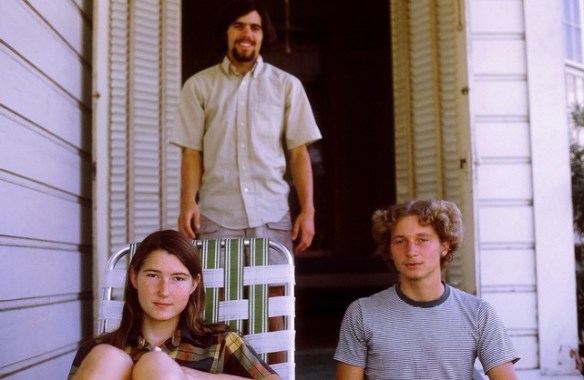
Annie, David and Mark, Stockton CA, 1972. Photo courtesy of Mom
In May 1972 David and I were college students at Raymond College, a small, experimental school in Stockton California. We were 21, living with 13+ friends in old mansion in the Central Valley: Organic garden, yoga at dawn, that kind of thing.
David and I had known each other from sixth grade or so, having grown up together in Orinda, California, next valley over from Berkeley- home at the time of People’s Park, the Free Speech Movement, and the iconic VeloSport Bike Shop.
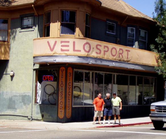
VeloSport Bike Shop, Berkeley CA
We didn’t own much, but thanks to VeloSport, we had really, really nice bikes: Raleigh Internationals.
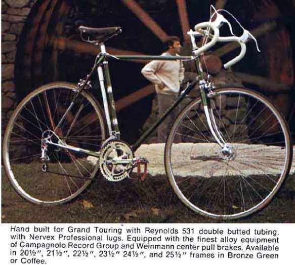
From the 1970 Raleigh Catalogue. Courtesy of Sheldon Brown
I had started riding in the mid-1960s in high school on a low-end Bianchi, from VeloSport. Bicycling for me wasn’t a social or a competitive thing, but rather a contemplative outlet. In our town only children rode bicycles, but I didn’t care. I didn’t seem to fit in anyway.
I would ride up alone on Wildcat Canyon Road to Tilden Park on top of the Berkeley Hills, and look out over the bay to San Francisco and wonder what the future might hold. I remember the smell of the wet Eucalyptus and some days the fog. Rarely would I meet another bicyclist.
If I did, they were invariably faster, older, dressed for the part and coming from the Berkeley side which meant – VeloSport connections.
Sometimes I would ride with David, and at times our rides stretched out. Our first longer ride was in 1967 when we rode from Lake Tahoe to the SF Bay area. We rode up Route 1 a couple to times from SF to Mendocino and in 1969 we flew to the East Coast with our bikes and almost ended up at Woodstock.
Of the two of us, David was always the responsible one. He planned. I would go with the moment. He was the cross country runner. I smoked my share of weed.
He and I had fallen for the same girl, Shirley, in high school. We both made our pitch and she chose David. Broke my heart, but so it goes. It was probably a good choice on her part.
David and Shirley were still together in 1972 and seemed destined for marriage, a happy home and stability, or so it seemed to me.
I, on the other hand, was adrift, something of a lost soul.
So that May of 1972, I was a bit shocked when out of nowhere, David suggested a long bicycle adventure for the summer. I wasn’t so sure.
But we brainstormed and came up with a ride across the USA.
10 days later we were putting our bikes together in the airport in Norfolk Virginia.
The Plan, or Lack Thereof
We decided to ride East to West because that way we would be riding home. We picked Norfolk because it was opposite San Francisco. The exact route we would work out as we rode.
We guessed it would take us a couple of months more or less. As long as we were back for Fall Term, no problem.
We were worried though, about Utah and Nevada. We had crossed in cars, but bikes were another matter altogether. The trick to driving had been to drive at night.
Bingo. The moon would be full. We could bicycle at night. More on that misguided fantasy later.
Since we both were on the very broke side, this would be a camping trip and we would eat out of grocery stores.
Training? David hadn’t been on his bike for a year, but he had been running – marathon distances. Me? Nada. Nothing. Would this be an issue? Yep.
Second opinions? We had never heard of any such trek, but maybe someone had. As the responsible half, David made the effort to find out what he could. He went to our oracle – VeloSport. They couldn’t offer any advice other than point him to an author of bicycle touring books, an expert who purportedly knew the terrain and challenges of various routes across the country.
So David calls this guy up, who pompously explains that our plan was simply stupid. We would never make it riding East to West across the heart of Nevada and Utah. Headwinds and heat would do us in.
He eventually added that he hadn’t bicycled any of our route himself, but knew a few people who had ridden West to East on a far more northerly route.
We already had our plane tickets. I shrugged and David wasn’t backing down. We’d do it our way.
As it turned out, the so-called expert was pretty much right. We almost didn’t make it and there were far easier ways across.
Perhaps easier would have meant better, but then again perhaps not. Our stories wouldn’t be nearly as dramatic.
Journals, Rejected Manuscripts and Amazon
 This write-up is anchored by David’s journals, which he worked up into a book-length manuscript in the 1970s.
He submitted it to Ten Speed Press in Berkeley for publication. It was rejected. Their loss.
It then morphed into a beloved scrapbook complete with many of the photos included here-in. Text was typed on David’s Olympia typewriter.
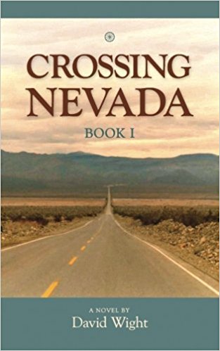
Recently David finished up Book One of his memoirs: “Crossing Nevada”. Available on Amazon.
Included are highlights of our crossing in June 1972.
Virginia and the Appalachians
The house icons on the map above are our overnights. This map is zoomable, as are all the embedded maps in this story.
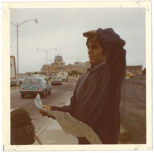
Mile zero. David looks West
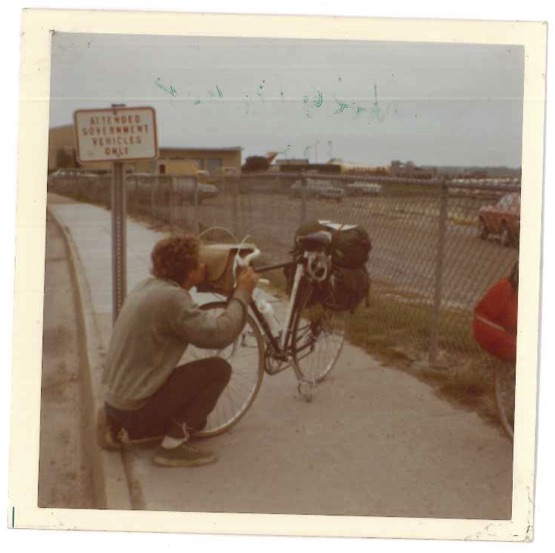
Mile zero. Mark gives the Raleigh a kiss
Day 1, Thursday, May 25, 40 miles to Suffolk, VA:

1972 Highway 58 Norfolk Traffic. Courtesy Virginia Department of Transportation
We put our bikes together in the Norfolk airport and headed off into city traffic mid-afternoon. We swung around the southern end of town and caught highway 58 going west. By evening we had logged over 40 miles. Afternoon showers had settled into a steady rain.
It was getting dark. As we rolled through Suffolk, jet-lagged, wet and hungry, we spotted Conways Truck Stop, a bright bustling complex.
The clincher was the big neon sign flashing “Bunks.” We pulled in.
We locked up our bikes, stepped back and gazed at them juxtaposed against the big-rig trucks. A couple of goof-ball jokes later we walked into Conways- ponchos, wool caps, hiking shorts, waterlogged sneakers and all.
We weren’t so sure that the joke wouldn’t be on us. No problem, no hostility, the laughter was friendly. Apparently Martians were welcome.
We sat down in a booth for dinner. It was a full house and the truckers around us wanted to chat.
“Why are you traveling on bicycles?” Which transitioned to prescient humor,
“How much horsepower do your bikes have?” Answer, as I was soon to find out: “Not enough.” And then there was what was to become the the ever-recurring,
“How far are you going?”
Curiously these guys didn’t doubt us. When we said, “California.” They simply took us at our word. Until we got to Colorado, most everyone else along the way simply thought we were joking. After a while we just told whoever it was, the next state over, and even that was met with disbelief.
For these guys though, a trip across the continental USA , was business as usual. The difference between truck and bicycle was a function of time. As one of our new friends put it,
“At the rate you two are going, it’ll take forever.” He added, “I’m headed to California. Will be there in four days. Why don’t you put your bikes in the back of my truck and come with me?” Temptation struck, although neither of us would admit it until much later.
After dinner we headed out back and claimed a couple of bunk beds. It was a full house. If memory serves, 20 to 30 truckers. The snoring was world-class. No problem. We slept just fine.
Up and at em early in the AM. Coffee and a bite to eat and we were on the road.

Day 2, Friday, May 26, 75 miles to West of Lawrenceville, VA:
We had picked highway 58 as our route across Virginia – a good choice – 500 miles from beach to bluegrass. Highway 58 slices cleanly through the many layers of East Coast America, from the Atlantic the the bluegrass country of Kentucky.
On our first full day of riding, we passed through a bit of the old south, a bit of old north, some prosperous towns, and some not doing so well. Not a whiff of 1972 California.
First up in the morning was Franklin, a clean prosperous town of a few thousand. Franklin had its beginnings in the 1830s as a railroad stop at the head of the Blackwater River, a steamboat to railroad hub with the brick mansions to prove it.
Thirty-seven miles further up the road was the town of Emporia, older yet- settled in 1710- and another transportation crossroads, sitting on the banks of the Meherrin River. During the Civil War the railroad was a tactical prize as Union troops sought to isolate the confederate capitol at Richmond Va.
Finally we passed through Lawrenceville, a town that had been scraping along for a long, long time. It’s claim to fame – “Brunswick stew”, also known as “Squirrel Stew”, “Matthews Stew” and “Haskins Stew.”
“Brunswick stew” because Lawrenceville is in Brunswick County. “Squirrel Stew” because the original meat was squirrel. “Matthews Stew” because it was a slave cook named Uncle Jimmy Matthews who shot the squirrels, skinned them, and and threw them into the pot with some bread butter and onions.
Outside of Lawrenceville, we set up camp in a pine grove about 100 yards off the highway. We weren’t carrying stoves and a fire would have drawn the wrong kind of attention, so no stew for us.
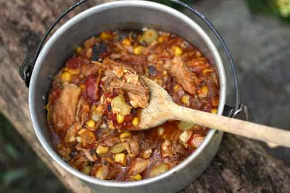
The Brunswick Stew we never had
That said, if I ever make it back, squirrel stew is at the top of the list.
Day 3, Saturday May 27, 93 miles to Danville, VA:
On our third day, we were up again before dawn. Weather was co-operating. Morning overcast gave way to afternoon clearing. We rode 93 miles on the day, through the towns of Riverdale, Clarksville and Danville. At the end of the day we found another nice campsite just off the road amidst thick oak and maple trees. We were on-script.
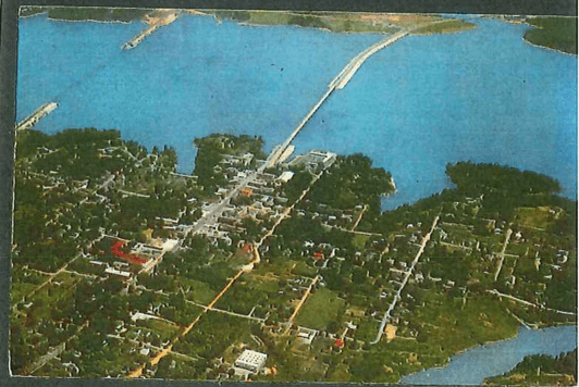
David’s 1972 Clarksville Postcard
It would all fall apart the next day.
Day 4, Sunday, May 28, 93 miles into the Appalachians to Hillsville, VA:
Beginning the foothills west of Martinsville
The Appalachians were taking a toll – on me. It was up, then down, and then up again- it felt interminable. Like a really bad waking dream.
In the middle of yet again another long climb, I pulled up and told David I wasn’t so sure I could deal with this trip. David graciously allowed me the space to have my 15 minute complete nervous breakdown.
My crisis past, we were on our way.
The day, however, was far from over. First we had to work our way over most of the Blue Ridge Mountains. Then we had our “Deliverance-Lite” encounter with gun-toting locals, followed by a descent in the dark, and finally a meeting of the minds with the local police, which turned out to be a turning point of the trip.
In David’s words:
“About seven miles east of the town of Hillsville, Virginia, we probably shouldn’t have lifted our bikes over the barbed wire fence and camped on the other side. But darkness was setting in and the fence too close to the highway to camp safely by the road.
As soon as we had spread our sleeping bags out over our ponchos, we heard the sound of a truck stopping on the road and the doors opening and closing—two of them. Moments later, we heard the creaking sound, probably of a gate about a hundred feet away, then saw the shapes of three large figures walking toward us. When they were within about ten feet of us, they stopped, all holding rifles.
We could barely make out their faces. One was a husky middle-age man, and he was flanked by two younger and equally husky men. Probably the man’s sons.
“What are you doin’ on our property?” the man asked.
His tone was cold, matter-of-fact.
We told him we couldn’t go any further and needed a place to camp.
His blank face expression didn’t change. He apparently wasn’t impressed.
“You two had better leave now.”
”Mark and I both nodded. “Sure thing,” I said.
They waited without budging while Mark and I packed our sleeping bags and ponchos into our saddlebags. We walked our packed bikes back to the fence and lifted them over. They followed close behind.
No one said anything as we rode off into the night, squinting for light.”
Our next stop was a small general store. Still unnerved we recounted the tale of our encounter to the middle-aged local behind the counter. No reaction.
After a pause, he leaned forward, looked directly at us and sent us on our way with words of warning, measured out for effect,
“Don’t sleep… on… The Mountain.”
An hour or so later we rolled into Hillsville, home of the Hillsville Massacre of 1912. The sentencing of Floyd Allen, patriarch of the Allen clan did not go smoothly. Five were killed including the Judge, Sheriff, Commonwealth’s Attorney, a Juror and an 18 year old girl brave enough to testify against the Allens.
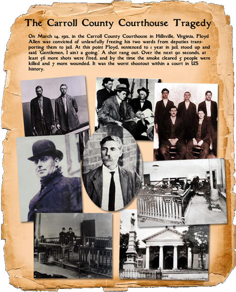
I wouldn’t be a bit surprised if up on the mountain, we hadn’t just met several of Allen Clan circa 1972, including the guy in the store. If not, close enough.
Our laid back California thing clearly wasn’t working here in the Blue Mountains. Time for a change of strategy. After a quick huddle, we decided to try the opposite end of the stick. No more sneaking around, jumping fences and the sort.
We’d try going to the police station and ask them where we could camp.
Good decision and a psychological turning point of the trip. Local authorities ended up being our best buddies.
We found the Hillsville police station, walked-in, and told our story.
As David put it,
“The officer looked us over for a moment with a nonplussed gaze. As though satisfied we weren’t a criminal element, he hinted a smile and had us bike behind him as he got in his squad car and slowly cruised to the edge of town to a local park. He said we could stay there for the night, but not to linger in the morning.”
We didn’t, and we slept well.
Day 5, Monday, May 29, 75 miles to East of Damascus, VA:
From David’s journal:
“Today, we got off to a late start (after 9:00 AM). Spent the early morning eating in a coffee shop. Ham and eggs, a just reward for yesterday’s plight.
Took our time bicycling. Stopped and took a little bath in the New River. Also stopped in every town for a rest and bite to eat…
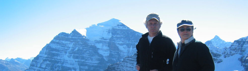
Late this afternoon, we bicycled around Mt. Rogers, which at 5,719 feet elevation is the highest point in Virginia. We felt good. Have made camp at a picnic area by a river. The forest around is very dense, and along with the oak, there are even pine trees. Nothing in comparison with the Sierras, our homeland, but for now, these do give a twinge of the the “country.”
Weather is still clear today. The same as yesterday ad the day before. Gets up to the high 70’s during the day and down into the 50’s at night. For bicycling and camping, it’s just right.”
Day 6 Tuesday, May 30, 116 miles to Jonesville, VA:

From David’s journal:
“The rain caught us on the mountain passes without a place to stay or eat. Abandoned stores and small towns (where oh where were Duffield and Stickleyville), rain-drenched fields and no shelter forced us to head into Jonesville, twenty-five miles further than we had planned to do for the day. Through rain and darkness, completely exhausted, we made it by 11:00 PM. 116 miles of bicycling, the longest day so far.
Found a town policeman (the only other person on the road at that time of night), and he guided us to the town park where we could stay. Really a nice place — a huge gazebo with three picnic tables. Three other guys (in their mid-teens) were also there, apparently hitting the bottle. Upon seeing us puffing into the park and to the gazebo, being escorted by a patrol car, they just didn’t know what to make of the whole situation.
The patrolman gave them a warm welcome (instead of busting them), proudly bid us welcome to the gazebo, and said good-bye. As if it was all in a day’s work. And we casually began conversing while eating our midnight dinner we picked up at a small store about two hours earlier. They were a friendly sort of people. Didn’t seem to know what to say or what to believe, though. Around 1:00 AM, they left and shortly afterwards, we went to sleep, using the picnic tables as beds.
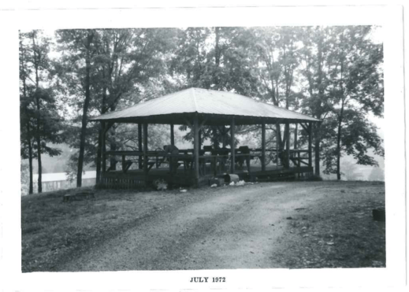
Jonesville Gazebo
In the morning, we awoke early and had a large cafe breakfast. Leaving town, it was a quick 40 miles over the Cumberland Gap and into Middlesboro by noon. 532 miles in all so far, and Virginia is a longer state than we thought.”

David’s 1972 postcard of the Cumberland Gap
Today in 2018, the Cumberland Gap we rode over no longer exists. The asphalt has been removed, and the land restored to its 1790s appearance. Now a centerpiece of the Cumberland Gap National Historical Park, a dirt road wide enough for a wagon crosses the gap.
A tunnel large enough for a four lane highway has been bored through the mountain below.
One branch of my family walked through the gap around 1780, when the gap was only a single-file trail. This first wave of Kentucky settlers are typically portrayed as brave and noble pioneers.
Suspect they were simply desperately poor, pushing for better circumstances. Some would boot-strap opportunity into fortune. To their credit.
Neither David nor I shed a tear on leaving Virginia. After crossing the Cumberland gap, we were into Middlesboro Kentucky before noon, and decided to call it an early day.

Goodbye Virginia. Photo looking back from near the Gap. Credit “Along Virginia’s Route 58”
