With the Ozarks behind us, we now faced the Great Plains of Kansas and Eastern Colorado: 688 miles of flat country before we hit the wall of the Rocky Mountains. No where to hide.
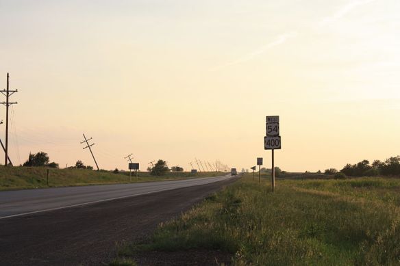
Route 400 a few miles west of Pratt Kansas. Photo courtesy of Wikipedia
We had chosen to cross Kansas on what today is US Route 400 which turns into US Route 50 after Dodge City and continues on to Pueblo Colorado.
Day 15, Thursday, June 8, 118 miles to Independence, KS
But first we had a 70 mile stretch on historic route 66 from Halltown to the Kansas border. We were up before six and after a light first breakfast we were on the road.
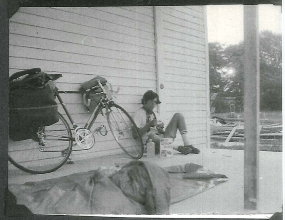
6 AM snack in Halltown, Missouri. David was in no mood for photos. He eventually cheered up.
We joked about riding on Route 66. We hadn’t planned for this stretch, but here it was.
Route 66 was a much bigger deal last century. Probably the most famous highway in the country. Route 66 epitomized road trip and adventure, thanks to the iconic TV 1960’s show and it’s snappy theme song.
The CBS show “Route 66”, which ran from 1960 to 1964, was an earnest, edgy serial about two young men on a random journey across North America in a Corvette. Swap out Corvette for a couple of bicycles and, voila, we were living it.
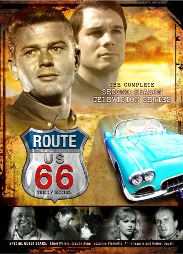
“Route 66”, the TV Series on CBS 1960 -1964
Three miles west of Halltown, we passed the Gay Parita Sinclair Gas Station, a beloved route 66 relic.
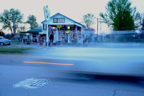
Gay Parita Sinclair Gas Station. Photo Courtesy of Andrew Evans, National Geographic Travel
And then after a couple of turns, we were on our own with the old road itself stripped of the culturally layered media narrative.
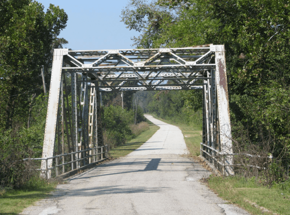
Route 66 west of Halltown. Photo Courtesy of Rick Martin
Late morning we hit Kansas, the Sunflower State.
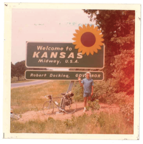
Welcome to Kansas, Midway, USA
Day 16, Friday June 9, 93 miles to Winfield, KS
From David’s Journal:
“Into Kansas yesterday and today. 95-100 degree heat and up to 35 mph headwinds from the southwest— toughest stretch of bicycling since we started. Surprisingly so, there are even a few hills here. Stopped and camped yesterday outside of Independence at a roadside rest after 118 miles. 93 miles today, stopping at a park in Winfield, a college town of 8,000 to 10,000 people. Winfield is one of the larger towns out in the Kansas plains.
Most towns average between 100- 500 people with one gas station, one general store, one bar and the highway going through the center of the conglomeration which is about 100 feet long before we’re at the edge of town again.
In this area, Winfield is considered to be “The City,” perhaps the biggest town outside of Wichita (45 miles northwest of Winfield) many people in this area will ever see.
One thing I can say for Kansas is that the parks and roadside rests are well-maintained—a big lawn amidst a grove of trees. Very inviting and special for a bicyclist. The simplicity of living in these towns seems appealing in certain ways…
1,439 miles on the road so far, getting near the halfway mark.”
Although I didn’t realize it at the time, all was not well on the girl-friend front for David. From an early draft David’s Book:
“In Moline [between Independence and Winfield], Kansas, I stopped at the post office, where Shirley said she’d send me a letter through general delivery. The letter was there, and I partly felt relieved and delighted, not feeling forgotten. I missed her terribly, but had tried to keep her out of my mind. She wrote that she missed me and couldn’t wait to see me again. It was a four-page letter, and she said nothing about Paul. Somehow, the omission spoke volumes. Maybe she was hoping more to ease my mind than have me fill in the blanks on my own, which I did.
I wrote her back a note telling her I missed her, too. Yet I wondered again if I was being a fool for keeping things alive with her. I truly did miss her, but I was glad to be more than two thousand miles away. Part of me felt in a hurry to get home. Another part didn’t feel in any hurry at all. I had no idea what to expect of either of us by the time I got home.”
Day 17, Saturday June 10, 124 miles to Pratt, KS:
The next few days are from David’s Journal:
“The winds were at our backs for most of the day, and we sailed 124 miles into Pratt. Also, thunderstorms have been threatening all day, yet never burst open until five minutes after we hit Pratt. And did it pour then. Must have rained three inches in two hours.
While the rain was coming down, Mark and I celebrated in a Smorgasbord.”
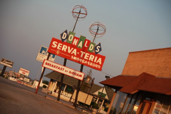
Gone now. Donald’s Serva-teria in Pratt KA – perhaps our smorgasbord. Photo courtesy of Miguel Llorente
As the rain poured, we ate, and ate seemingly impossible amounts of food. We had been riding from dawn til dusk for weeks, and our metabolisms had geared up accordingly.
We had our plates piled to the max the first time though, but that was just the warm up. Second time through to the max we started getting looks.
And we started laughing and then couldn’t stop, and as we ate, we laughed til we cried. We just didn’t get full. It was uncanny.
Fourth time through with full plates, we knew we were on a roll, which sideways glances confirmed. And we laughed all the more.
Those hot dog championship guys, had nothing on us.
They say riders in the Tour de France burn between 4000 and 6000 calories a day, and on mountain stages can burn 7000 or more. We were likely in their ballpark.
For context, a regular guy on a regular day, needs between 2400 and 3000 calories.
We had each lost over 10 pounds since Norfolk, and it wasn’t for lack of eating.
From David’s Journal:
“After the storm let up, we went to Lemon Park in town and have found a gazebo to sleep under. Many families have brought their Saturday Dinners here — apparently this park is very popular. Many old people here too…
A few days ahead lay the Rockies and the high mountain passes. After all we’ve gone through up to now… I’m no longer worried about us not making it.
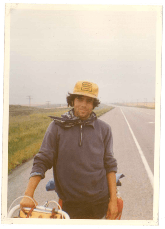
David proudly wearing his road-find Kansas tractor hat
A special note of interest I somehow forgot to mention is Mark’s dazzling new haircut. As a cleansing act, he shaved it all off in Cairo. The style now bears some resemblance to the bald eagle. I must say, it certainly looks interesting.
The storms broke loose again tonight. Looks ominous for tomorrow. Sure wouldn’t want to be stranded in Pratt. Somebody had better find a new name for some of these towns.”
Day 18, Sunday June 11, 100 miles to Cimmaron, KS:
“Last night, the storms were heavy and long, lasting all night. Turned to mist and overcast by this morning, and we headed out. Forgetting that stores would be closed on Sunday in the small towns along our route, we paid the price — no food until Dodge City, 80 miles from Pratt. We were very tired.
Dodge City, the “genuine” western town we had always heard about, was more myth than reality. The city is mainly modernized, and the actual “western scene” consists of one small block on the industrial side of town. So much for the “West.”
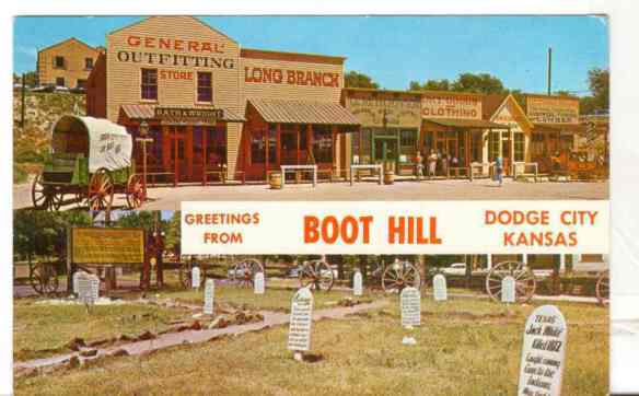
Postcard of Dodge City’s Entertainment and Exhibit Theme Park
I’m not sure what David and I were expecting in Dodge City, but a one block, PG, family-friendly, entertainment and theme park wasn’t it.
I suppose we were expecting a trace or at least some glimmer of the place that was known a hundred years earlier, as the most violent and lawless town in the old West.
The original WestWorld, before HBO.
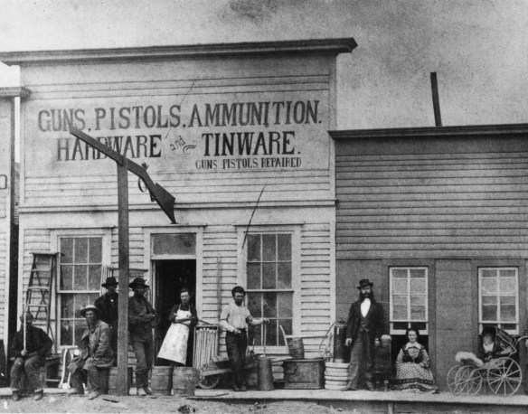
Dodge City 1872
The kind of place you could get “Guns. Pistols. Ammunition” along with your “Tinware” at the hardware store and the local burial ground was known as Boot Hill, for good cause.
David and I assumed that the theme park had just been dropped down randomly on a couple of low rent empty lots. We were wrong. Although we didn’t realize it at the time, we were actually standing at ground zero, a few of real-estate generations in the future.
After Boot hill came a school. Human bones were still being found by kids at recess, if rumors are to be believed,
Then came a city hall.
The circle, was closed with a surreal twist when the Boot Hill Museum and theme park graveyard was built on top of the real deal.
If that weren’t strange enough, out front in 1972, we were faced with a supersized, goofy, unrecognizeable, fully-colorized statue of a gunfighter.
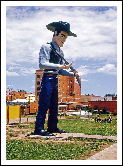
1972 photo of the Matt Dillon statue in front of the Boothill Museum. Photo Courtesy of Steve Brown
Was it Wyatt Earp? Bat Masterson? Buffalo Bill? Real-life legends, who walked the streets in Dodge City?
No, it was TV-character Matt Dillon from “Gunsmoke”, which ran from 1955 to 1975. The longest-running, primetime live-action series of the 20th century. Seems TV had trumped the history books. Nothing new there.
Matt Dillon was blown over in a windstorm in 1979 and never replaced. He had had a good run.
“Skies cleared by afternoon and after a rest in Dodge City, we cycled 20 miles to Cimarron, a town of about 1,000 people. Camped at the town park.
Slowly , the land is beginning to change, becoming a little dryer every day and a little wilder, too. The big granaries in the towns (which are visible from 5-10 miles away) are less common, and the farmland (outside of grazing land) is becoming scarce. Traces of the desert and dry lands are here, and the farmlands are left behind until the Central Valley of California, over 1,200 miles away.
Tonight the stars are out in Kansas, but looking toward the western horizon, massive clouds rest on the mountains (still a few hundred miles away), and lightning silently lights the western sky off and on. From here the power seems quiet and harmless. In two or three days, we’ll be in the middle of it and find out”
From the middle of Kansas the Plains tipped up imperceptively. It seemed flat, but every day from Winfield on, we gained between 750 and 1000 feet in elevation. Winfield KS is 1129 feet above sea level. By the time we hit Pueblo CO we were 4692 feet above sea level.
The highest point in Kansas is Mt Sunflower at 4039′ above sea level, right next to the Colorado border, roughly 80 miles north of where we crossed. The photo below of Mt Sunflower tells the flat-tale.
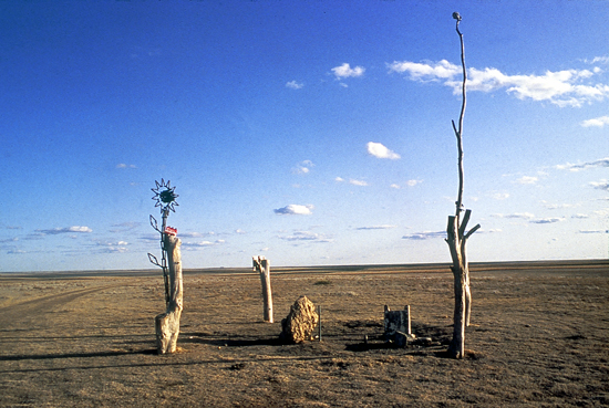
Mt Sunflower Kansas at 4039′ above sea level. Highest point in Kansas. Photo courtesy John Charlton/KGS.
Day 19, Monday June 12, 133 miles to Lamar, CO:
From David’s Journal:
“We left Kansas with a tailwind helping us and made it to Lamar. 133 miles, the longest day yet. Watched a few games of girls’ softball and waited until the end. Right after the last game, the lights in the whole park were turned off. With everyone having gone home, we commenced to set camp on the bleachers in the grandstands behind the plate. A very fine home these baseball parks can be.”
Day 20, Tuesday June 13, 120 miles to Pueblo, CO:
“Today was difficult, and it was a good surprise to make it to Pueblo. After a couple of blowouts and bike problems, we stopped at Fowler for an afternoon break. Ahead, the clouds were pitch black with lightning an thunderstorms blocking the entrance to the Rockies. The clouds were building up quickly and the winds were picking up to 30- 50 mph from the west. (a direct headwind if we were to continue). At this time, there seemed to be no sane reason why we should continue that day or until the storm had passed. Logic, however, didn’t seem to carry much weight. I can’t really figure out what happened to it. Perhaps we thought that nothing could stop us at that point. And maybe the winds and storms where what we wanted. They do add a little spice to the trip, that’s one thing. Yeah, it would be something to tell our grandchildren about someday, too. So we headed out. Sure enough, the winds were violent, and lightning bolts were dropping from the sky right and left. Sometimes we could see three or four bolts striking at the same time. Yet, and it’s still too amazing to believe, there was one small clearing in the storm, one little gap to Pueblo.”
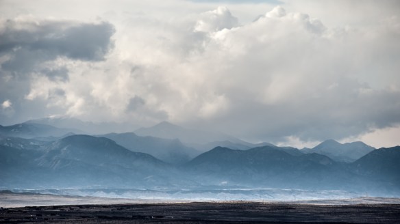
The Rockies behind Pueblo. Photo courtesy of MAPLOGS
And the highway weaved directly into the clearing. To our north by two miles, two inches of rain perhaps fell within a span of one hour. The storm to the south was equally as strong. We got a few drops of rain on us, but that was all. The winds also died down about twenty miles east of Pueblo, and we ended up cruising into town. We were truly gifted today.”
We stopped at a gas station, which doubled as a U-Haul rental site. The owner let us sleep overnight in one of the trucks. Nice guy. Nice digs.
Pueblo meant the end the Plains and the beginning of the Rocky Mountains.
