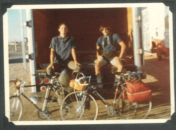
Our U-Haul Campsite in Pueblo, Colorado
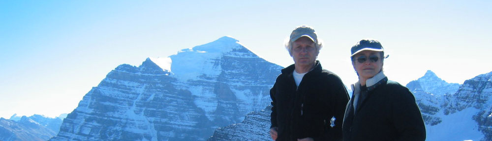
The above might be my favorite photo of the trip. I’m not sure why.
Perhaps, because David and I both seem relaxed, and very present. The Japanese have a word for this –“Sonomama.”
Perhaps, because it’s simply compositionally a great shot of us, our bikes, and this odd, but perfectly practical U-Haul campsite.
Perhaps because, I have a soft-spot in my heart for Pueblo.
Four years later I would be living with my-wife-to-be a bit south, on the back side of Greenhorn Mountain: no phone, no TV, 10 miles to the mail box, a loaner 4 wheel-drive V8 Chevy pick-up, mountain lion screams at midnight; peyote road men. Memorable days.
Sharon and I would make regular trips up to Pueblo for well pumps and the sort. Pueblo was a dusty, hot, hard, little city, but it had great food, if you like puerco asado, homemade tamales and the such.
The wedding ring I am wearing as I write this, was purchased in Walsenburg, next town south.
For David and me, Pueblo meant the end the Plains and the beginning of the Rocky Mountains. From Pueblo we followed the Arkansas River west and up along highway 50, crossing the continental divide at Monarch Pass, 11,312 feet above sea level. From there we gradually descended a bit over 7000 feet, making our way across the Colorado Plateau to Green River in Utah, where we knew the desert waited.
Day 21, Wednesday June 14, 83 miles into the Rockies, to the west of Howard, CO, along the Arkansas River

Our ride up along the Arkansas River
Day 22, Thursday June 15, 88 miles over Monarch Pass (11,312 feet) to Blue Mesa Reservoir, CO:
The next few days are from David’s Journal:
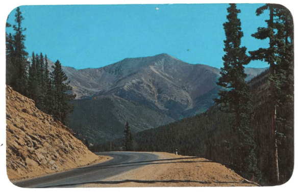
David’s Postcard: Up to Monarch Pass
“Over the pass at 11,312 feet. Steep climbing began past the mountain town of Salida, but not quite steep enough to break our steady pace. Met another cyclist on the way up (Rick — he’s touring around Colorado for a week) and all made it to the top for lunch.

Across the Continental Divide at Monarch Pass: Day 22, Thursday June 15
Tired and satisfied, the celebration was sweet, and we got quite obnoxious about the whole thing.
Party time at Monarch Pass
Continued on, coasting downhill for about ten miles and then hit a long plateau for another twenty. Took turns setting the pace and reached the town of Gunnison by mid-afternoon. A big thunderstorm which had been building all afternoon finally broke loose, and we waited it out in town.
Storms seem to come every afternoon these days. All the locals keep saying it will never rain, and that we shouldn’t worry about getting stranded. They’ve been saying that since Kansas, though, where drought predictions changed to flood warnings when we passed through. Perhaps we are the rainmakers. Ought to go through Arizona where it hasn’t rained in 164 days. We’ll change things.
Anyway, the storm didn’t pass over until late this evening, so we cycled very little afterwards, choosing to camp at Elk Creek Camp along the shore of the Blue Mesa Reservoir. It is a tranquil place amidst the mighty Rockies, and we shall perhaps make tomorrow a rest day here.”
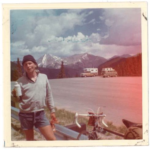
Day 23, Friday June 16, Rest Day
“Took the day off. Slept until 6:20 and woke up wide awake. Too used to getting up at 5:00. Rick took off this morning and will continue circling the Rockies to Durango. It was good to share the absurd lifestyle with one who knew it well.

Blue Mesa
Spent the day washing clothes and repairing our sew-up tires.”
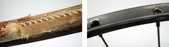
Sew-up tire and rim. Photo Courtesy Park Tool
Sew-ups are a tire casing sewn around an inner tube and then glued directly to the rim. We were riding high-pressure sew-ups because they were light and fast. Today the performance gap between sew-ups and clinchers has closed considerably, but in 1972, there really was no comparison.
To repair a sew-up, first you need to find the puncture, then remove a section of stitching and pull out the tube, patch it and finally restitch the tire. It’s finicky and time consuming work, better suited for a break day than an emergency stop by the side of the road.
“Now we each had four good spare tires apiece, a little security for the desert crossing ahead. A little, not a lot.
Thought of getting home, and as nice as finishing the trip might be, I’m not ready to face the end. This journey has become a way of life, and I’m happily becoming adjusted to it. Perhaps the desert will change my mind.”
Day 24, Saturday June 17, 110 miles leaving the Rockies 110 to Grand Junction, CO:
“110 miles today (2,197 in all), being chased to Grand Junction by a big thunderstorm which hit just as we reached town.
After a little climbing, we coasted out of the Rockies. The first 71 miles were easy, and with the Rockies no longer posing as a possible barrier to the west, we began thinking it would perhaps be coasting from here on. Especially if the desert heat waves had yet to arrive. A quick dose of desert reminded us, though, that the desert would not permit the crossing to be easy. No way. After leaving Montrose, we hit the windstorms, the heat and the expanding thunderheads. We missed the storm, but the winds and heat still made the going tough, much tougher than the climb up Monarch Pass or any other stretch we have crossed The fears we had of headwinds are returning.

David gluing on a sew-up
Tonight, we found a big motel room (with kitchenette) for $3.00 apiece. Mapped out the route across the desert. There are stretches where it is an eternity between towns, the main stretch being 161 miles between Delta, Utah and Ely, Nevada. There would definitely be days we’d go without seeing a town, and possibly no water. We’ll have to pack extra food and maybe up to two quarts of water apiece. As much as we can hold. Usually we put away between 6 – 8 quarts a day. Every drop is needed. Two quarts, then, is still less than we really need. So I don’t know how the going will be. We had thought of bicycling at night and resting during the day.
Original plans were to reach the desert when the full moon would be near. But as it stands, we are almost ten days ahead of our original schedule and there will only be a very small moon to guide us through the night. Anyway, clouds have been out most nights and black out all light.
Another thing we just learned is that rattlesnakes tend to come out at night and bask on the highway. I can see it now, bicycling in the dark with irritated snakes lunging at us. At least we won’t die of boredom out there.
Anyway, that’s tomorrow. Nothing we can do to change it. Now, it’s conk out time.”
Day 25, Sunday June 18, 106 miles to Green River, UT:
Highway 50
“Hit the road before dawn. As soon as the sun came up, the heat bore down. Soon, the headwinds began to blow. We crossed the Utah border, going through long dry valleys only to get to the next ridge and find another long valley spreading out without any sign of a town. The road narrowed and became bumpy, making the pace rough. Finally, by early afternoon, we spotted the town of Thompson, dimly visible in the distance. Took refuge under one of the few trees in town, guzzled down over a quart of water each, had a little lunch, and rested. The heat was cruel, up to around 110 degrees in the sun, and we were exhausted, and our spirits were low, especially coming off such a relatively fast and easy crossing over the Rockies.”

Thompson
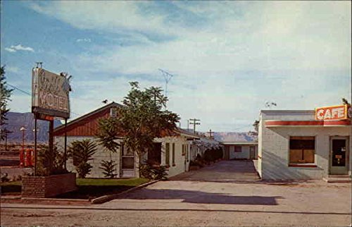
“With about an hour and a half of rest in Thompson, we continued into an even more desolate stretch. And the weather shifted, with thunderheads spreading into the big basin, becoming broader, taller and blacker by the moment. To our surprise, we came to a gas station and cafe at Crescent Junction (eight miles up the road from Thompson).

Crescent Junction Gas Station and Cafe. Postcard. c. 1960
We waited in the cafe to see what kind of treat the desert was brewing up. Lighting bolts and thunder were already closing off the road west. Looking far ahead, it seemed that, while about fifteen miles wide, the front was only 5 miles deep, but growing in all directions by the minute. Our best bet, we judged was to ride through the storm as soon as possible.

Utah lightning close to our route. Courtesy of @q__j_____
Shortly after heading out, a highway patrolman pulled over ahead of us, flagged us down, and gave us a short, well-meaning, but entirely misguided, lecture on riding bicycles in desert thunderstorms:
“Your rubber tires will provide insulation from any lightning strikes hitting the highway nearby,” he advised. “Don’t get off your bikes, or the lightning current will get you from the ground.”
He sounded like he knew what he was talking about, so we took his advice to heart. But, as we found out later, he didn’t have a clue either.
There isn’t enough rubber in a bicycle tire to slow the 30,000 amps of charge, the 100 million volts of electric potential, and the 50,000°F that the average lightning bolt carries. We should have waited out the storm in the cafe.
Off we rode, straight towards that raging lightning storm.
“Within minutes after he drove off, we closed in on the storm. We found ourselves in a strange silent calm zone – still and dry. The storm loomed ahead, a wall of darkness, 1000s of feet high and miles wide. Then we were inside and the rain hit us at full force and lightning was striking all around. With flapping ponchos and soaked bodies, we rode on and on through the nightmare.
After about half an hour, we came out the other side and were back in the heat. Fifteen minutes later we were completely dry again. Then my rear tire blew out. At least didn’t go while fighting through the storm. Replaced the tire and cruised into Green River, a small desert oasis 106 miles from Grand Junction, Colorado.”
Green River Postcard
We had intended to stay in Green River and then head northwest to Provo on highway 50 the next day before veering southwest to Delta Utah.”
However, that sensible plan was not to be.
On reaching Green River, we stopped at a gas station to top-up our tires and check for campsites for the night. As fate would have it, the kid on duty was the proud son of a construction supervisor who had worked on the-recently-opened Interstate 70 to Salida.
The kid gushed on about the road. How it was an engineering marvel. How it saved 100 miles on a cross country trip such as ours. How it passed through the middle of virgin Utah mesa only ever seen before by Indians, prospectors, and the toughest of cowboys.
He added that for the most part I-70 was still only one lane in either direction and there was little traffic. All of which sounded good.
There were downsides, however: No Services for 105 miles; extended 8 percent grades and brutal desert heat.
Adventure beckoned. We would try the the new Interstate. We came up with what we thought was a clever plan. We would start that evening, thereby putting a big dent in the following day and avoiding much of the heat and the hellacious daytime winds.
What could go wrong?

No Services 105 Miles
From David’s Book excerpts:
“After resting for about an hour in the park that evening, we mounted our bicycles and headed west out of town, hoping for a reprieve from the wind and rain.
Such was not to be. Before even making it five miles out of town, we got caught yet again in a suddenly brewing thunder shower (windy of course) that slowed our traveling to a crawl. We accepted the weather experience as par for the course. Luckily, the storm soon subsided, and we believed conditions would improve.

Up through the Mesas. Postcard
But they didn’t. Five miles later, we began climbing the steep, long grade of highway heading into the San Rafael Reef, a wide mountainous rock wall that extended much of the way across central Utah, over which barren mesas towered everywhere. The Interstate didn’t veer at all around this endless-looking wall, but instead went straight ahead and into it, entering a small gap between two mesas and ascending with long, slow switchbacks for miles. After more than an hour, we reached what appeared to be the top of a mesa, only to find another mesa cropping up further ahead and even higher than the one we had just climbed. Again and again, the highway ascended and descended in what seemed a never-ending stretch of mesa hurdles to climb over.
By then the sun had long disappeared behind the clouds and western horizon. No cars passed in either direction. Not even a sliver of a moon appeared in that murky night, filled with clouds and thunderheads.
By eleven PM, we had ridden what felt like twenty miles out from Green River and could go no further. Our legs felt rubbery and our spirits were low. We laid our tarps and sleeping bags down just off the freeway and slept on the hard, crusty, warm ground…”
