Day 26, Monday June 19, 105 miles to Salina, UT
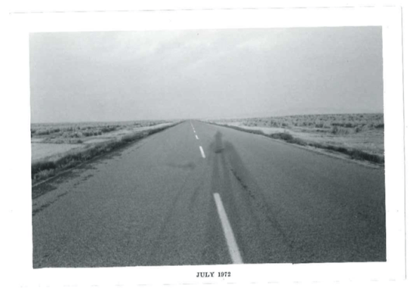
We were back on our bikes early the next morning while it was still dark and continued our climb up through Spotted Wolf Canyon into the San Rafael Reef. When we topped out at well over 7000 feet, it was light enough to look around. We were both impressed and intimidated. The road was brand new but the landscape timeless, untouched by man as far as the eye could see in any direction. Lost Horizons USA, if you will. The last wild frontier.

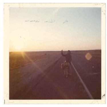
Lost Horizons USA. Above the San Rafael Reef
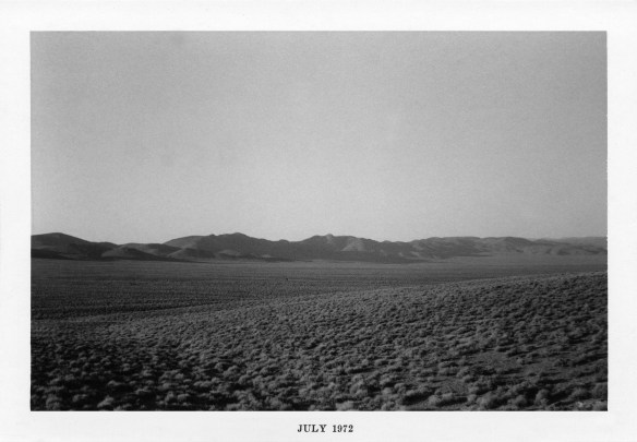
This was really big, bleak, empty and desolate mesa country.

San Rafael Reef. Courtesy of Wikipedia
Before the early 1970s, no one had any idea this world existed. Once I-70 opened, though, and traffic picked up, this other worldly landscape found its way into our 21st century popular culture.
Planet Vulcan landscapes for the 2009 Star Trek film were shot within just a few miles of our overnight in 1972 and the Mars Desert Research Station was set up just down the road in the early 2000s.

So that day in 1972, one could say we woke up on Vulcan or Mars, and, on theme, knew we were in for one hot day.
As the sun climbed into the cloudless sky, the heat rose quickly and the headwinds picked up.
This mesa country was not without charm. There were picturesque sandstone formations, desert waterways, expansive panoramas, and deep canyons. Aesthetic charm wore thin quickly though, in the wind and heat.
By mid-day, the temperature in the shade had to be well over a hundred. There was no shade, except under highway signs where we huddled for our breaks.

We joked about it being too hot for rattlesnakes and who the fools were. Yes, that would be us, the two goofballs dressed for the part. Half foreign legion, half surfer: bandanas over our heads, tucked under our caps and cut-off jeans, t-shirts and tennis shoes.
By early afternoon, our water was running low. It was time to consider a plan “B”.
Back to David’s excerpts:
“We continued to climb what felt like endless mesas one on top of the next, with the descents far too few and way too short. With still more than fifty miles to go to the town of Salina, we were down to a half bottle each of water. At this rate, we weren’t going to make it. Our breaks were becoming more frequent, our core body heat maxing out.
We thought about what to do if things didn’t improve.
We could wave down a passing car or truck and beg for water, and a ride to town.
But would another car or truck pass by at all? And if it did, would it stop for two crazed-looking bicyclists?
As if on cue, a car appeared and disappeared before we had a chance react.
We stopped yet once again in the shade of the next highway sign. Things weren’t looking good for the home team. Back on the bikes we rode on.
It was then that I saw what I couldn’t believe: a creek, a hundred feet or so off the highway on the right.
I set my bicycle down. I knew it wasn’t a mirage—though I was in a sorry enough state to see one.
I’d just wade in and sit a while.
I set my wallet and sun glasses down, walked in, and plopped down. Cool water soaked into my skin and flowed through my t-shirt and shorts, seeping into my socks and shoes. Mark lowered himself in a few seconds later. We splashed our faces and used our bandanas as washcloths to wash off the layers of salt and dust that had built up on our parched skin.
We didn’t drink as we didn’t trust the water.
We could have spent the rest of the day there cooling down, but we knew we had many miles yet to go. Dripping wet, we climbed out of the water, gathered our wallets and sunglasses, and sloshing in our shoes, headed back to our bikes.
Just up the road, almost miraculously appeared a wide dirt pullout with a water faucet and a sign next to it: “WATER IS DRINKABLE”, with additional wording and compliments from the Utah and federal highway departments.
We drank long and hard, refilled our water bottles and extra jugs, and for good measure, showered our heads a couple of times. Back on the road, reinvigorated we knocked off the last of the climbing in this unforgiving mesa country. From there, the last 24 miles to Salina, all felt downhill.
The home stretch towards Salina
The strong headwind was a small price to pay. We were going to make it.

Greetings from Salina Postcard
That evening, we feasted in Salina and camped—with blessings from the local sheriff—on the lawn in front of a cottage used as the town’s police station.”
Day 27, Tuesday June 20, 71 miles to Delta UT:
“We were on the road early and rolling along the highway towards Delta UT, when we spotted two shiny objects slowly coming towards us in the opposite direction along the road. It took quite a while to figure out what we were seeing, but as we closed we realized we were not alone. Here were Compañeros, two other long distance bicyclists, a man and a woman.
We shared stories by the side of the road. This young couple were coming from Lodi, California, almost 700 miles into their 1600+ mile ride to Kansas. We were roughly 2500 miles into our 3200 mile ride to the San Francisco Bay Area.
Our routes and desert stories were remarkably similar with one exception. Heat and water were issues for all of us, but where we had headwinds, they had tailwinds. We weren’t sure they appreciated how lucky they were.
We warned them about I-70 and told them about the water spigot. Somehow, they neglected to tell us about the water halfway across on the 165 mile stretch of highway 50 to Ely. Perhaps the bar had been closed when they rode by.
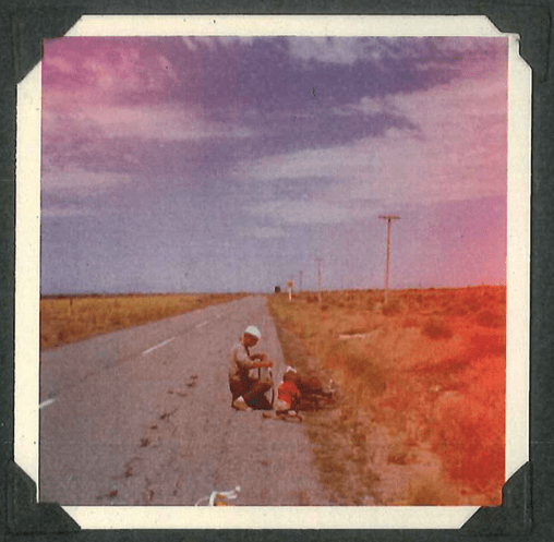
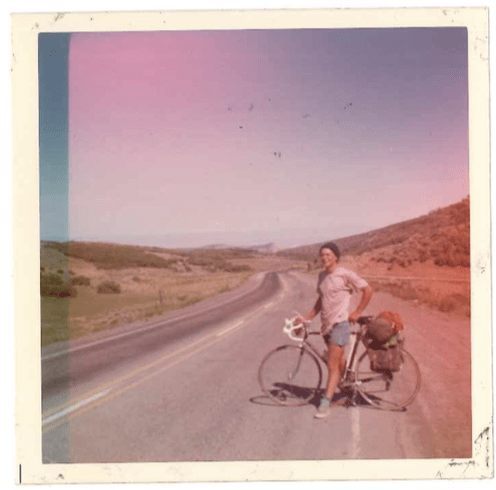
Mark fixes a flat on the way to Delta
We arrived in Delta in the early afternoon around 2:00, and we decided to call it a day at 71 miles. It had been an easy day. The winds had been mild, the climbing minimal and temperatures below 100 degrees. We had more miles in us, but we had learned our lesson in Green River.
Better to stop and give ourselves time to recover and prepare. Riding exhausted out into the night and the San Rafael Swell, hadn’t been the smartest of strategies.
This next 161 miles with no services to Ely promised to be even more challenging, so we decided to just kick back in Delta and relax for the rest of the day. Our waitress at dinner gave us a pep talk and encouraging words which proved prophetic.
She thought that perhaps the bar at the Nevada border would be open.
Bars without towns apparently didn’t show up on maps.”
Day 28, Wednesday June 21, 107 miles to Sacramento Pass NV
“The view of Highway 50 looking west toward the waning sun gives insight into why AAA once warned motorists [1986] “not to drive there unless they’re confident of their survival skills.” Photo by: David Braun.” From Nevada Magazine
The stretch of Highway 50 we now faced, would become famous 14 years later thanks to a Life Magazine article which described it as “The Loneliest Road in America.”
Although we didn’t realize it at the time, this route had history: American Indians, Early explorers – such as Jedediah Smith and John C. Fremont, Overland Stage Coaches and the Pony Express.
“We left Delta before dawn. Along the flatlands it was cool and calm. We knocked the first 25 miles or so off in a little more than an hour. Then as the sun rose the headwinds picked up, we were barely making 7 mph.
We headed into a small mountain range called the House Range. The climb itself wasn’t bad, but by then the heat and headwinds were taking their toll. We reached a plateau and headed for the Confusion Range.
At first, the range appeared very close, but distances in the desert can be deceptive. We thought the range was about 10 miles or about an hour away with the headwinds. In reality, it was 35 miles and over four hours away.
Finally, we began our ascent up the barren and high wall. As we climbed, we kept thinking we were getting close to the top, but it was a cruel tease. Temperatures were well over 100 degrees. Up and up we climbed. Finally when we reached the pass, we couldn’t quite believe it. Expecting the worst, we headed down the other side.
But lady luck was smiling.
We actually coasted downhill, and then it was relatively smooth sailing through the long wide valley to the Nevada border, where, yes, the bar was open.
It was just us and grey-haired, gnarly old codger who owned the place. No surprise there, the bar was the only sign of life we had seen along the highway all day. We refilled our water bottles and then sat on the porch and traded tales. He had owned the place 20 years and planned on dying there.
We talked campsites and weather. He suggested a campsite with water just up the road a ways, on the other side of Sacramento Pass. With a twinkle in his eye, he noted that a big storm was brewing.
During our stop, the clouds had thickened and blackened to the west, over snow-capped 13,000+ foot Wheeler Peak. The wind, right on cue, began to howl. We walked our bikes back to the highway, only to be met by a stream of high-speed tumbleweeds bouncing by. The old man was laughing.
Expecting the worst we slowly headed off. Remarkably, the wind soon let up. The expected blinding rain never arrived. The storm itself seemed to be holding back behind Wheeler Peak, slowly building in strength. It would arrive in full fury the next day.
We made our way up and over Sacramento Pass at 7136 ft, found the spring a couple miles down the other side as described by the old man at the bar, and set up camp.
Remnants of clouds lingered overhead and dusk set in earlier and stayed longer than previous nights. Temperatures continued to drop, probably below sixty, and for the first time since leaving the Rockies, we felt cold enough to wear long-sleeved sweat shirts and pants. For dinner, we ate canned tuna on bread. Tasted great.
Curiously, this most-dreaded day of the trip hadn’t been so bad after all, and ended on a high note.
Day 29, Thursday June 22, 44 miles to Ely, NV:
We awoke to a foreboding, gloomy, overcast sky, not the usual weather pattern we had come to expect – a clear, sunny morning, heat rising by noon, and a late afternoon thunderstorm.
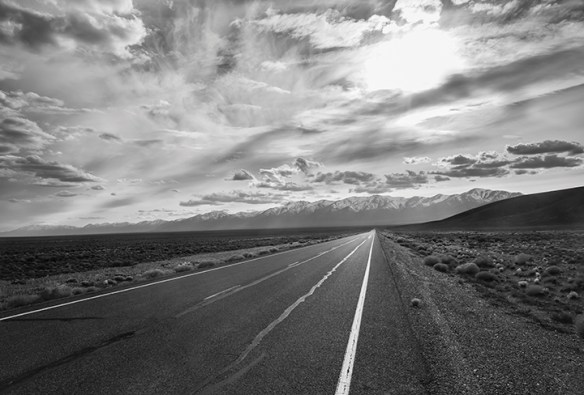
Endless Highway to Ely
The wind was already strongly blowing in from the Schell Creek Range to the west with nimbus clouds dropping over the valley before us, obscuring it in an ominous sheet of rain heading our way.
We pushed our way down the mountain fighting a stiff headwind. The next ascent was a relief. Nothing new here for us. In the desert, exposed downhills were tougher than wind-protected ascents.
This first wave of the storm caught us climbing Conner’s Pass at 7,723 feet. It rained hard, but soon the storm passed over, the winds died down, and we sailed into Ely, arriving late morning.

Greetings From Ely Postcard
The sky above was bright blue with thick fluffy clouds as we were eating lunch and pondering the afternoon stretch. Then we noticed a municipal truck, starting and stopping as it slowly made its way down the street, the driver and partner frequently jumping out, lifting sand bags from the back, and dumping them at regular intervals.
This truck was joined by two others, which began unloading even more sandbags. Merchants were arranging the sandbags in front of their stores, motels, and casinos.
Not a good sign. Someone knew something we didn’t know.
So we wandered over and asked- Emergency flood warnings for the rest of the day.
The monster storm we had seen the previous day behind Wheeler peak, was now bearing down on Ely.
Flash floods could close off our route in a number of spots. And the clincher, if we were to head out, we’d just make extra work for those who would have to come looking for us. We were convinced.
“Then, the storm hit in the next half hour, and lasted the rest of the afternoon, pelting the roof of the gazebo where we huddled, with hail that sounded like rocks. The wind blew against the trees at full force, large branches swaying and bristling as though ready to break loose and crash over the bandstand. For a while, the rain plummeted straight down on the roof. Then the wind shifted, and the rain blew sideways. Although we were protected by cottonwoods all around, the wind shook the rain loose from their swaying branches, and torrents of water blew under the roof of our gazebo. We put our ponchos on and moved our bikes to the far end of the gazebo, where we huddled just out of reach from the blowing rain.
That evening, the clouds began to clear, and the air remained cool, filled with the smell of cottonwoods. People clambered back into the park, families and young people loitered at the picnic tables and under the trees, and one group of teenagers bounded into the gazebo. When they saw our bikes and heavy-laden saddlebags, their eyes widened, and they peppered us with questions about our trip.”
We spun our tales to laughter all around. The storm had been cathartic. 2,630 miles down and only a bit over 500 miles to go.
Day 30, Friday June 23, 110 miles to the middle of the desert, NV:
From David’s journal:
On Highway 50 out of Ely
“Skies were clear, when we left Ely before dawn, but soon clouded up. Oh well. With headwinds and rains once again, we climbed four passes. Each somewhere between 1,000 – 1500 feet of climbing. We passed through the old mining town of Eureka, our one town for the day, before making camp at a rest stop in the middle of nowhere.
This wasn’t just any nowhere though. It was a nowhere with a water faucet, a picnic table, and “Kings” and “Queens” outhouses.”

Mark on his throne
The majesty of the desert was on full display. Layers of clouds caught the evening light and reflected off the mountain ranges far off on horizons in every direction. This was big-sky, empty country. No trees, no anything, just sagebrush in every direction and the two outhouses. We felt very, very small & found it all remarkably funny.
A tip of the hat to whoever put those big “Kings” and “Queens” signs on the outhouses. We got the joke.
110 miles today, 2,740 in all.
Day 31, Saturday June 24, 148 miles to Fallon, NV:
“A long, challenging, but ultimately satisfying milestone day.
Headwinds began howling just after dawn, and temperatures quickly rose from the 50’s to up over 100.
We climbed Hickson Summit at 6,564 feet, and Scott’s summit at 7,267 feet. The climbs just kept coming. Up the switchbacks we went at a snail’s pace, with the sun beating down. We climbed Austin Summit at 7,484 feet, and with our energy fading, rode into Austin.

Austin Nevada
We were tired and discouraged and only 35 miles into the day.
The next town was Fallon, another 113 miles. Purportedly there were bars and cafes along the way, but we weren’t sure we could count on them.
After a good rest and much thought, we set our sights on Fallon and rode on.
25 miles northwest through a valley and up a ridge. Then 35 miles through a valley heading southwest against a 25 mph headwind.
We took turns leading and drafting. We stopped at a small cafe in the late afternoon after 95 miles and took a breather, but we didn’t stay long. Remarkably, we were getting stronger as we rode. Into another valley and up over Sand Mountain, the miles kept slipping by into the evening.
Finally, on reaching a low ridge, a wide basin of salt flats spread out before us. About 25 miles away, in the center of the flats, we could see a faint patch of trees and a water tower. It was Fallon.
We took a break and gazed silently out onto the wide, shiny basin. Then it was back on the bikes for the final stretch. The temperature was dropping, and the winds were dying down. We sailed across the salt flats at full tilt. We didn’t stop for water or take another break.
We rolled into Fallon just after the sunset.

Fallon Postcard
Today we had had the same unrelenting headwinds, heat and interminable climbing, but this time we powered through. A day to remember.
The day’s 148 miles brought us near the western edge of the Nevada desert. Carson City was only another sixty miles, and then, the Sierra Nevada Mountains of California. Home territory.
In Fallon we celebrated at a Dairy Queen and indulged in the luxury of a motel.
2,888 miles down, 290 miles to go.”
Next: 6. California and Home
