
Everything we read said, “Don’t try to hike from the rim of the Grand Canyon to the Colorado River and back in one day.” Looking at the trail guides though, it seemed possible. Challenging, but feasible in the Spring or Fall when the weather was cooler and the trails free from ice.
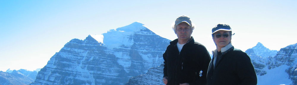
Sharon and I knew we wanted to hike down inside the Canyon, the further down the better. The river sounded pretty tempting. If we could get there, we could take another trail out, and we could mail our postcards from Phantom Ranch.

We found our rationalization/ inspiration on the internet. Some folks were doing our contemplated route. Not that many age 55 and up, but figured our orneriness would compensate (somewhat) for lack of spring in the knees, which is kind of how it all worked out.
Once we had our hotel reservations in October 2006, the next step was to pick up the pace on our exercise program. I continued walking 3-4 miles a day during the week and on Fridays and Saturdays Sharon would join me. On Sundays we pushed it up to over 4 hours. This was the most we could fit in, given our schedules and New England’s winter weather. Would it be enough?
We were confident that we could keep moving for a long time. The 17+ miles seemed within our reach. The big unknown was whether our legs and lungs could handle the descent (4780’) and the ascent (4380’). Another wrinkle was altitude. The South Rim was over 6000’ higher than Cambridge. Our contemplated hike promised to be a significant cardio-vascular challenge.

I figured our mini expedition was the perfect excuse for getting new cool hiking gear. We picked up new GoLite lightweight day packs, new lightweight trail shoes, new Leki Ultralight trekking (telescoping) poles and LED headlamps, should it get dark. At the time, thought the trekking poles and lamps a bit goofy. Was I wrong. As it worked out, the poles saved our knees and the lamps saved the day.
On March 23, 2007, we flew into Phoenix and drove up to Flagstaff. The next day we took our time on the way up to the Grand Canyon stopping at Wupatki National Monument. The Pueblos there dated from around 1100. Very interesting and wonderful country. We lingered.
By the time we arrived at our Hotel, the historic El Tovar, we were still a bit jet-lagged. The pending question was when should we try for the big trek? Sooner was decided to be better as our legs would be fresh and there would be less time to worry and obsess.

Our wake-up call the next morning found us lying wide awake at 5:00 AM. By 5:35 we were walking through an empty lobby with our packs and poles.
By 5:50 we were on the shuttle bus to the S. Kaibab Trailhead. The crowd on the bus was a curious mix of sleepy park employees heading to work, tourists heading to overlooks for sunrise, and apprehensive hikers like ourselves who weren’t quite sure what they were in for.
By 6:30 AM Sharon and I were on the trail. We chose the S. Kaibab trail for our descent as it is one of the few trails which follows open ridge lines and therefore offers spectacular panoramic views of the main gorge. It is also steep with no shade or water and has 400’ more in elevation change than Bright Angel Trail, our selected return route. Since it would be down one and up the other, a descent of S. Kaibab in the cool of morning seemed preferable to an ascent in the heat of the afternoon. Think we made the right choice.
There were four of us starting down the trail together heading to the river and back. Our companions from Santa Fe promptly left us behind. A pattern which would repeat throughout our canyon stay. We never passed another hiker on the trails. Many passed us. Can live with that. Our day might come. If not, that’s OK too.
In any case, we must have hiked for about an hour before our first break. The panoramic views were indeed stunning and the sunrise was wonderful. The trail was steep with many mule steps which required full attention. No guard rails here. A slip or a trip in the wrong place and it is a long way down. Passed a Condor perched about 30’ above the trail. One big bird. The size of a medium-sized dog, but with feathers.

A bit later passed two ravens. Cool customers. Much character.
In the first hour we descended over 900 feet in a mile and a half. Lots and lots of tight switchbacks on these upper cliffs. Temperature was warming up. It was in the 30°s at the trailhead. By our first break our jackets were off. Would guess we were already into the mid 40°s. By the time we would reach the river, it would be over 80°.
While we were sitting munching our energy bars, three runners swept past. This was the extreme crowd. Am guessing they were on a r2r, rim-to-rim, run. Some are even able to fit a r2r2r run into one day, though they don’t get much sleep.
After another hour or so about 1/4 the way down the switchbacks following Skeleton point, we stopped to chat with one of the guys from Santa Fe, with whom we had started off.
He was about our age ± and was turning back. Said he had bladder leakage and showed us his wet pants. Thought to myself, “This guy is remarkably comfortable talking about such a sensitive subject.” Then he added that he was worried about having enough water. Was this a real medical emergency?
Debated with myself whether to offer him one of my 4 bottles. Knew I could refill at the river, but wasn’t sure if water would be available at Indian Gardens half way up Bright Angel Trail. If not, figured I would need all four bottles. On the other hand, if this guy was really in trouble, felt I should probably risk it.
After a few more delicately probing questions it became clear he was not experiencing a medical emergency, but simply an equipment malfunction. It was the water bladder in his pack which was leaking and he still had two full water bottles. I told him my worries about his seeming urinary condition. He laughed and said something like, “No leakage there yet. Hopefully not for a long long time.”
For the next hour we continued with our descent to the Tonto Platform, the broad shelf between the upper canyon walls and the inner gorge. Another half dozen or so rim-river-rim day hikers passed us checking their watches as they hurried along. This was the late-start crowd and mostly novices like us. They were young though (under 30) and seemed to bounce down those mule steps. Made me envious.

By 10:00 AM we had crossed the Tonto Platform and were about to descend the final 1200’+ of the inner gorge to the Colorado River. It was probably only around 70° but with the exercise and the sun beating down on us, it was starting to feel really hot. Sharon took the bandana from around her neck and put it over her head under her baseball-style hat so that it would act as a shade for the back and sides of her neck. In another couple of hours I would do the same thing.

We crossed the Kaibab suspension bridge over the Colorado River about 11:00 AM. We had made it down. The bridge itself is very cool and only used by hikers and mules. It was finished in 1928 and is over 400‘ long and hangs about 60’ above the river. The floor is wood, hung by galvanized cables clamped to the main cables above which in turn are anchored into the canyon walls 80 feet above. A little tunnel leads through the cliff to the bridge.
After a break at the bridge, there was still another very very long 3/4+ mile to Phantom Ranch. Along the way we passed the outlines of pueblo occupied by Ancestral Puebloans around 1100. These people used to be called Anasazi. No longer. Turns out Anasazi is a Navajo term which translates roughly as “enemy ancestors” or “ancient people who are not us.” Many modern Puebloans of direct descent, including the Hopi, took offense. So now it is “Ancestral Puebloans.”
We dragged ourselves into Phantom Ranch around noon. Phantom Ranch is a little oasis at the bottom of the Grand Canyon, complete with running water and cottonwood trees, a miniature resort village run by the Park Service, accessible only by foot trails, the Colorado River and helicopter. We mailed our postcards getting the coveted “Mailed by Mule at the bottom of the Grand Canyon, Phantom Ranch” postmark. Not surprisingly Sharon had written hers already. Buena idea.

Sitting at the picnic table next to us was this old guy fiddling with his stove, brewing tea. He had nice gear and it was well used. It looked like he did a lot of hiking/camping.
Turns out he does. His name is Laurent “Maverick” Gaudreau and last year for his 80th birthday he decided to do 80 rim-to-rim hikes to celebrate. Ended up doing 106 R2Rs. Quite the character.
The rule of thumb is that it takes twice as long to hike up as it does to hike down in the canyon. Although neither Sharon nor I mentioned this to the other at Phantom Ranch, we both did the math in our heads: 4 1/2 hours down meant 9 hours to go: we would hit the rim at 10:00 PM. A bit depressing, but it would be what it would be.
Back at the river about 1:00, we stopped to chat briefly with a couple of big tough young women who had passed us on the way down. They were done for the day. Their final destination had been Bright Angel Campground next to Phantom Ranch. They asked where we were headed. When we said, “Back up to the rim” one looked at us with a poker face, and without a word just clapped twice, which I interpreted as, “way to go, old folks.” And we were off.
Back across the river. This time over Bright Angel suspension bridge. After a mile or so of paralleling the river we turned up a side canyon towards the Devil’s Corkscrew. Maverick had informed us that a hiker had died on this section of the trail last summer. “When they found him, the temperature was 120°.”

By the time we hit that stretch, thankfully, parts of the corkscrew were already in the shade. Up we plodded. We climbed out of the inner gorge and followed Garden Creek up to Indian Garden. Arriving around 3:30PM, Redbuds were blooming along the creek. We were making pretty good time considering. Only 4.5 miles and 3000’ to go.
While we were refilling our water bottles and snacking, we struck up a conversation with three young women also on a rim-river-rim hike following the same route we had chosen. They had left Phantom Ranch slightly ahead of us and had been lounging at Indian Garden for some time.
They had missed sunrise on the trail, because “Someone, wanted to eat breakfast in a restaurant.” Two rolled their eyes towards the third who was doing calisthenic-like stretches. Curiously they looked/sounded like they were just hanging out between college classes.
As they pranced off up the trail, they called back, “See you at the top.” I mumbled, “I doubt it.” Tinkling laughter drifted back and they were gone. No doubt they arrived at the rim hours ahead of us. Youth is a wonderful thing.

Although we were on the weary side, I was starting to feel more confident. We were going to make it, and well before 10:00. By sunset at about 6:30 we had passed Three Mile Rest House (and emergency telephone) and were into the last ascent.
We turned on our lights at 7:15 and were standing on the rim at 7:45 PM. Shudder to think, what the last stretch would have been like without the lights. Here’s to Petzl Headlamps and converted LED Mini-Maglites!
Now we just had to find our hotel. I hadn’t quite worked that one out. Sharon was not amused. After a couple of wrong turns, we finally made it to the veranda of the El Tovar where we found nice comfy wicker chairs and plunked ourselves down. It took at least 10 minutes for Sharon’s blood pressure to come down and for us to collect our energies for the final climb to our room on the third floor.
After couple of hot showers we collapsed into bed by 9:00, without dinner.

Predictably, the next day we could barely walk. After breakfast we hobbled back to the Bright Angel trailhead to see the section where we came up in the last stretch. Probably a good thing we hadn’t seen this before the hike. We took it very easy for the rest of the day.
The following morning we hiked 8-10 miles of the Rim Trail West of Grand Canyon Village. The trail winds through pinyon and juniper and in many parts runs right next to the edge into the canyon. Edge, as in slip sideways 3-4 feet, and you land a couple of thousand feet below. Again, no guard rails or other barriers, except at the shuttle bus stops. Made for fantastic views though. Nice level walk, even an old stagecoach road thrown in. Our favorite at the front desk, runs it at night on full moon days with her friends. Sheesh.

We took a day off to cruise Desert View Drive. Loved the vistas, but the crowds can be a bit much. Time after time we saw folks goofing off right on the edge of the canyon beyond the guard rails. Prime candidates for the Darwin Awards. After a while we just had to avert our eyes. Tourists fall to their deaths just about every year here. A fascinating read: “Over the Edge, Death in the Grand Canyon” .
On our last full day at the canyon, we hiked 2.5 miles, 1760’, down to Santa Maria Spring from Hermit’s Rest. A bit off the beaten track. Nice intimate trail with only glimpses of the main canyon. Someday would like to go all the way down this route to the river.
After climbing back to the rim at Hermit’s Rest in reasonably good humor, we met a sweet elderly couple from the UK sitting quietly gazing out over the canyon. They had just started their own 13 week tour of the American West having just flown in from Australia.
We exchanged a few travel stories and ended up encouraging them to visit Jerusalem. They were hesitant because of the perceived danger. Then after a pause, the woman looked up at us and said with twinkling eyes, “Maybe. After all, our motto is : Advencha before Dementia”
